
Partington Cove Trail in Big Sur, California
Partington Cove is one of the best short hikes in Big Sur. A steep dirt road drops you into a redwood canyon, across a little wooden bridge, and through an old tunnel blasted into the cliff, then pops you out above a turquoise cove.
It’s only about a mile round trip, but it packs in history, creek views, and some of the bluest water on the Big Sur coast. Here’s everything you need to know before you go.
📌 BEFORE YOU GO
- Where: Highway 1 in Julia Pfeiffer Burns State Park, about 2 miles north of McWay Falls
- Parking: Free, in dirt pullouts on both sides of Highway 1. It fills up on weekends
- Hike: About 1 mile round trip, all downhill on the way in and a steep climb back out
- Dogs: Not allowed on the trail
- Tours: Big Sur, Monterey and Carmel tours
🏨 Where to stay: Big Sur (closest) · Carmel-by-the-Sea (about an hour north) · Monterey (more options)
Where Is Partington Cove?
Partington Cove is on the Big Sur coast in Julia Pfeiffer Burns State Park, about 2 miles north of McWay Falls and roughly 9 miles south of Big Sur village.
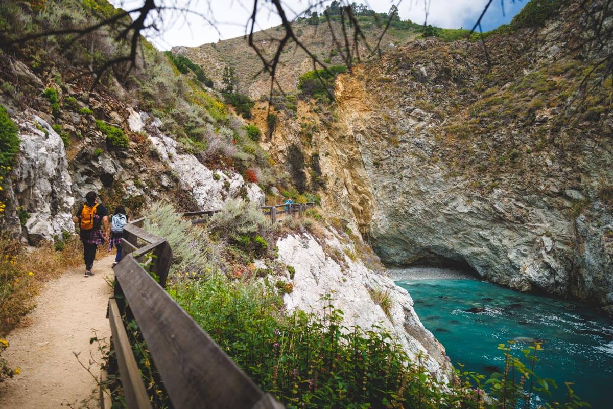
The trailhead is just a green gate on the ocean side of Highway 1, right where the road crosses Partington Creek. It’s easy to miss, so slow down as you get close. You can route yourself here to the trailhead. Download your map offline first, since you probably won’t have cell service out here.
There’s no parking lot, just dirt pullouts on both sides of the highway. It’s free, but spots fill up fast on weekends and holidays. There are no restrooms at the trailhead.
📍 GET THE ULTIMATE CALIFORNIA MAP 🗺️
Get our curated list of the best adventures and things to do north of LA loaded onto your maps with just two clicks!
✅ Waterfalls ✅ Hikes ✅ Viewpoints
✅ National Parks ✅ 1400+ Pins

The History of Partington Cove
The cove is named after John Partington, who ran a landing here in the late 1800s. Workers stripped bark from the tanoak trees in the canyon (it was used to tan leather), hauled it down by wagon, and loaded it onto boats waiting in the cove.
To get the bark to the water, Partington had a tunnel about 60 feet long carved right through the cliff. That tunnel is still there, and you’ll walk through it on this hike. Local lore says rumrunners used the cove during Prohibition too.
Hiking the Partington Cove Trail
Distance: About 1 mile round trip
Type of Trail: Out and back
Difficulty: Moderate (steep climb back up)
Elevation Gain: About 300 feet
You’ll start at the green gate on the west side of the highway. From there, an old dirt road switchbacks steeply down the ravine toward the ocean, with big cliffs all around you.
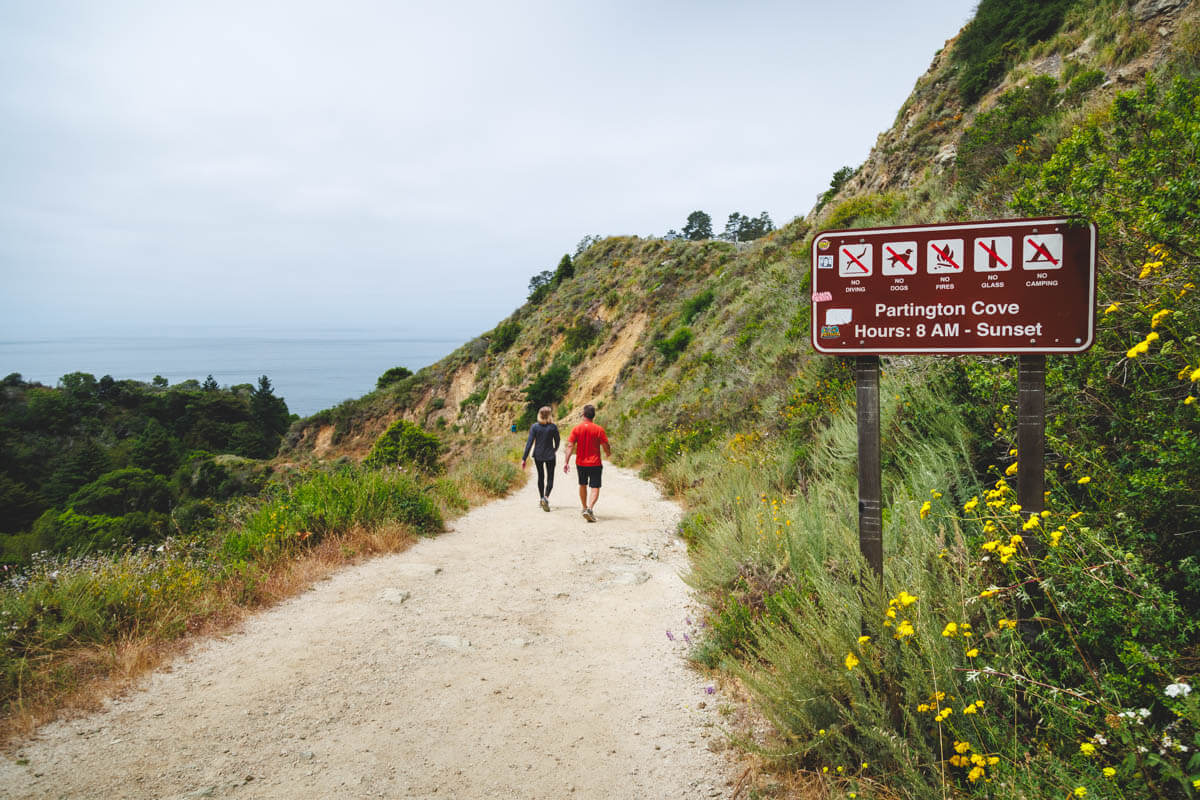
Don’t let the short distance fool you. It’s all downhill on the way in, which means it’s all uphill on the way out. Take it slow on the climb back, and bring water.
At the bottom of the hill, the trail splits into three short spurs. They’re all quick, so we recommend checking out every one.

The Beach Spur
The path to the right leads to a small, rocky beach where Partington Creek meets the ocean. Well, sometimes. Depending on the tides and the season, there might not be much beach at all.
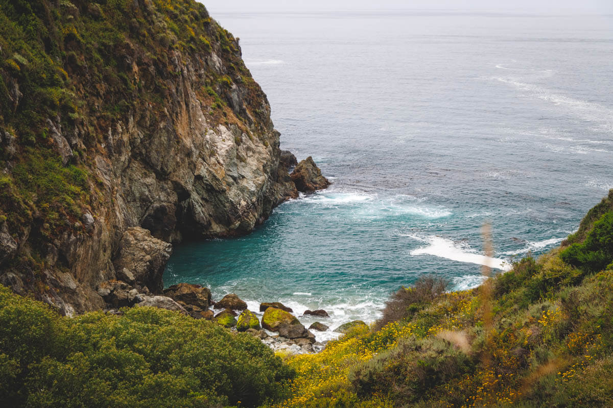
Expect big granite boulders, driftwood, and heavy waves. This isn’t a beach for lounging, and swimming is a no-go. The view from above is often the best part.
The Creek Spur
Head left and a short path follows Partington Creek inland, with shady spots on boulders and fallen logs where you can sit and listen to the water. After a wet winter, you’ll get little cascades too.

The trail here is narrow and sometimes lined with stinging nettle and poison oak, so watch where you step.
🏨 Need a place to crash nearby?
From rustic cabins to boutique inns—check prices and availability in just a click.
Through the Tunnel to Partington Cove
This is the star of the show. Go straight ahead at the bottom of the hill, through a grove of coast redwoods and over a simple wooden bridge. Then you’ll reach the old tunnel.
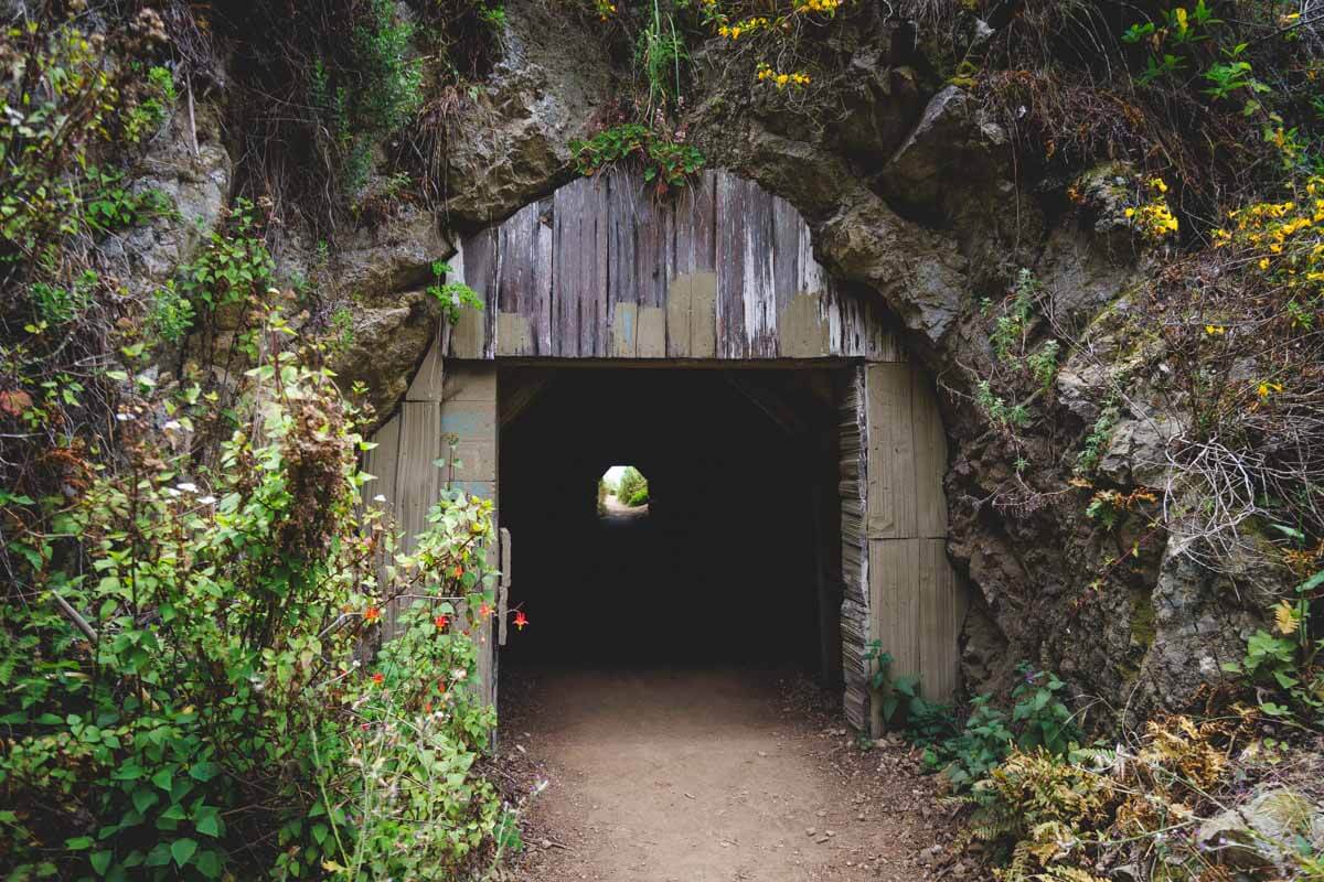
Walk through the dark 60-foot tunnel and listen to the waves get louder. When you come out the other side, the turquoise water of Partington Cove opens up right in front of you.
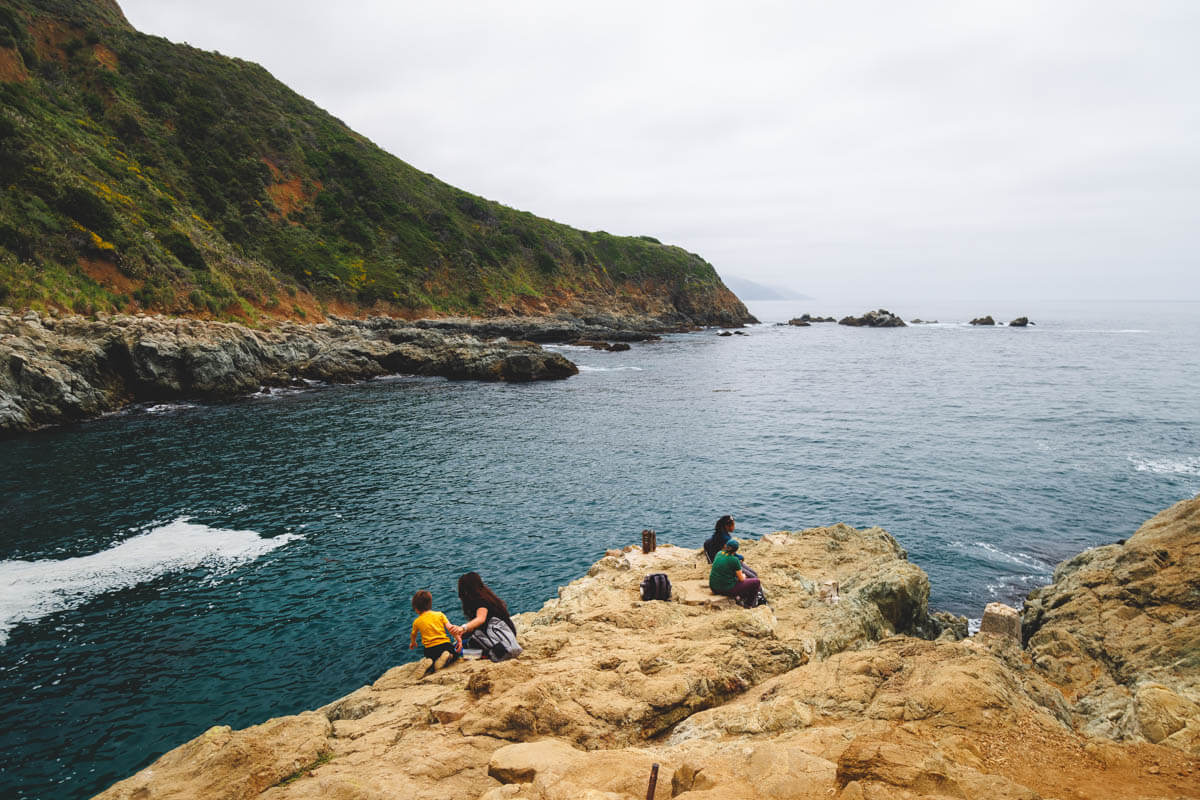
The path continues a bit farther to an overlook with a bench, where you can spot a few old bolts in the rocks from the original landing. You can scramble on the rocks, but they’re slippery when wet, and big waves do hit here, so be careful.
Want to wake up in Big Sur? Rooms are limited, so book early.
Where to Stay Near Partington Cove
Big Sur itself is the closest place to stay, but there aren’t many rooms and they go fast, especially on summer weekends. Look at hotels in Big Sur first, then widen your search to Carmel-by-the-Sea or Monterey, about an hour to an hour and a half north, where you’ll find a lot more choice. Coming from the south? Cambria is a cute base too.
Want to camp? Pfeiffer Big Sur State Park has a big campground in the redwoods, about 20 minutes north. A vacation rental is a good option for groups.

Where to Stay Near Partington Cove
Tips for Visiting Partington Cove
- Go early: Parking is limited to the highway pullouts, so arrive in the morning, especially on weekends.
- Wear real shoes: The trail is steep and dusty, and the rocks by the cove are slippery.
- Bring water: There are no restrooms or water at the trailhead, and the climb back up is a workout.
- Stay out of the water: Waves and currents here are dangerous, so enjoy the cove from the rocks.
- Check before you go: Highway 1 and Big Sur’s parks can close for storms, slides, and fires. The Tanbark Trail across the highway has been closed after wildfires, so check the State Parks page before you plan a longer hike.
More to Explore Nearby
Partington Cove pairs perfectly with other stops along Highway 1. McWay Falls is just 2 miles south, where an 80-foot waterfall pours onto a beach you can only see from above.

From there, keep exploring with our list of the best hikes in Big Sur, or plan your whole day with our guide to the Big Sur drive.
FAQs About Partington Cove
It’s about 1 mile round trip, a little more if you explore all three spurs at the bottom. Most people spend 45 minutes to an hour.
It’s short but steep. The way down is easy, but the climb back up to Highway 1 is a real workout, with about 300 feet of elevation gain.
No. The waves and currents are dangerous, so enjoy the cove from the rocks and the overlook.
No, dogs aren’t allowed on the Partington Cove Trail.
Yes, it’s about 2 miles north of McWay Falls on Highway 1. There’s no trail between them, so you’ll drive from one to the other.
🕒 Save hours of planning time! ⛰️
📍 Get The Ultimate West Coast Map
1400+ breweries, trails, waterfalls, beaches, and weird roadside stops—mapped for you!
Final Thoughts
Partington Cove is proof that the best Big Sur hikes don’t have to be long. In about an hour, you get redwoods, a creek, a piece of history, and one of the bluest coves on the coast.
Go early, take your time on the climb back up, and pair it with McWay Falls for a perfect Big Sur morning.
Read more of our guides from around Big Sur:
- Things To Do in Big Sur: 16 Best Stops on a Big Sur Drive
- 9 BEST Hikes in Big Sur
- Guide to Garrapata State Park
- McWay Falls in Big Sur
- Partington Cove Trail in Big Sur
- 14 BEST Things to Do in Cambria
- 16 BEST Things to Do in Morro Bay
- 12 Marvelous Things To Do in Monterey
- 25 Best Things to Do in Carmel-By-The-Sea
We hope this helps you plan your trip to Partington Cove!