Golden Gate National Recreation Area: What to Know
The Golden Gate National Recreation Area is HUGE, so huge, in fact, that it is one of the largest urban national parks in the world.
The area spans 75,398 acres and comprises both land and water, complete with 28 miles of coastline waiting to be explored.
Think towering cliffs, long and sandy beaches, forests of redwoods, winding trails, and plenty of history within the sprawling land. As well as natural wonders, the historic sites of Alcatraz and various forts and batteries bring some history to this epic landscape.

The area is not as simple as being one big park; it is spread across numerous sites, making navigating it slightly confusing. It is spread over the counties of Marin, San Francisco, and San Mateo and can be split into different sections, which we will do for you below.
Table of Contents
- Golden Gate National Recreation Area
- South GGNRA—Presidio of San Francisco
- North Golden Gate National Recreation Area
- Hang out at Rodeo Beach
- Lagoon Trail
- Stroll to the Batteries and Forts
- Learn more at the Marine Mammal Center and Whale Skeleton
- Point Bonita Lighthouse Hike
- See Everything Above on This Awesome Hike!
- Battery 129
- Slacker Hill Trail
- Kirby Cove
- Battery Spencer Trail
- Do it all by Bike
- Stop at H. Dana Bowers Rest Area & Vista Point – Northbound
- Discover the Unique Fort Baker
- Tennessee Valley Area
- Muir Beach Area
- Muir Woods
- Mount Tamalpais
- Final Thoughts on GGNRA
Golden Gate National Recreation Area
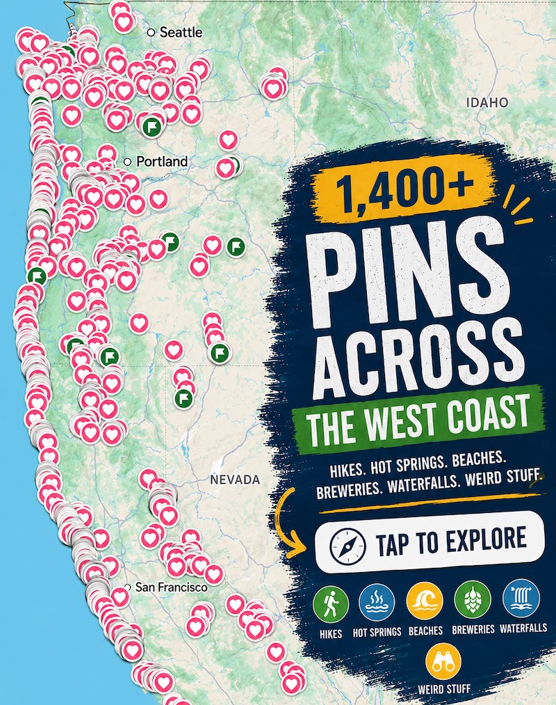
So let’s get real for a sec, this area is massive and confusing. I don’t know about you, but visuals help me better understand things, so we made you a handy map so you can better see this vast but amazing park.

The way we set up this guide for you is going from south to north. North and South Golden Gate National Recreation Area (GGNRA) are the most visited and most popular. This will probably be the area you’re thinking of and have seen in pictures.
With that said, the other areas in the far north are also very worth visiting!
Under each GGNRA area below, we listed all the best things to do—tried and tested! We’ve visited this park numerous times over the years, hiked the trails, AND parked on the butts on the beaches!
Parking and Access Around GGNRA
Let’s talk a little bit about the parking and access at the Golden Gate National Recreation Area, as it can be tricky in places. Before heading to an area, it is always worth checking to see if a fee is involved with your visit.
For example, the Tennessee Valley area doesn’t charge a fee, while access to Muir Woods National Monument is $10 per adult, or you can choose a $40 annual pass.

When it comes to parking, there are plenty of parking lots scattered throughout GGNRA. When parking, ensure you always follow the posted regulations. Most parking lots are charged by the hour, and some have a time limit.
📍 GET THE ULTIMATE CALIFORNIA MAP 🗺️
Get our curated list of the best adventures and things to do north of LA loaded onto your maps with just two clicks!
✅ Waterfalls ✅ Hikes ✅ Viewpoints
✅ National Parks ✅ 1400+ Pins
South GGNRA—Presidio of San Francisco
The southernmost part of the park is known as the Presidio of San Francisco area, and although it is the southernmost end of the GGNRA, this part of the park wraps itself around the north end of San Francisco.
Spanning almost 1500 areas, the Presidio is huge as a standalone park. Sitting on the edge of one of the most beautiful bays in the world, it is clear to see why it is so popular for all kinds of people, including hikers, families, history buffs, and sports enthusiasts, to name a few.
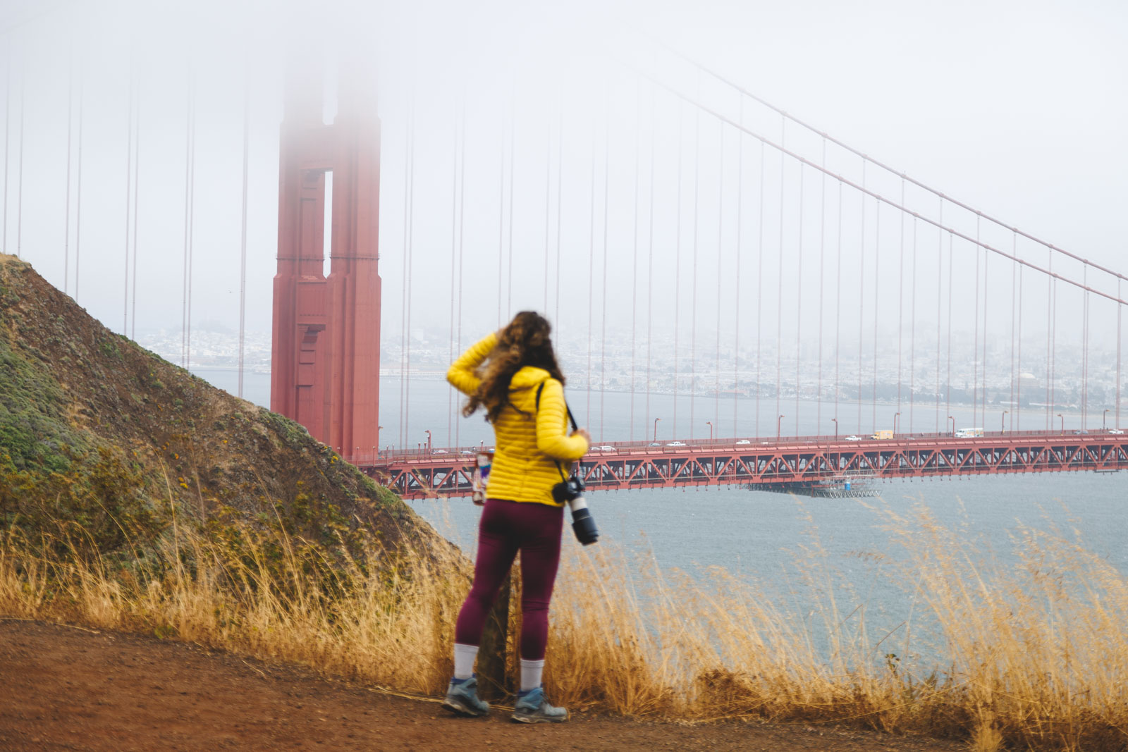
Watch the Sunset at Baker Beach
This area of the park has many beaches, but one of the most popular is Baker Beach. As well as being a beautiful beach, the room doubles as one of the most spectacular viewpoints of the Golden Gate Bridge. The mile-long swath of sand has plenty of facilities for a day of sea and surf, with picnic tables, grills, restrooms, and two free parking lots for easy access to the sand.

It is also a great sunset-watching spot and one of the closest beaches to the bridge.
Check Out Marshall’s Beach
Marshall’s Beach is another excellent beach near the Golden Gate Bridge. It is the closest beach to the bridge, but relatively few people make the trip. Unlike Bakers Beach, it doesn’t have a ton of amenities, but this means it is often quieter and not full of families, making it ideal for those who want to explore without the crowds.

The beach hugs the coastal bluffs and requires a short hike to reach the Batteries to Bluffs Trail. Be aware, due to the lack of crowds and more out-of-the-way locations, a few people dare to go bare, so you could always try it if you don’t mind the cold!
🏨 Need a place to crash nearby?
From rustic cabins to boutique inns—check prices and availability in just a click.
Get your History Fill at Battery Cranston
San Francisco is a history lover’s dream. There is no end to the historical landmarks scattered over the Golden Gate National Recreation Area, and Battery Cranston is just one of them.

The battery was built back in 1897 to provide seaward defenses, armed with guns ranging about 10 miles! Today, you can still visit the battery on the bluffs near the Golden Gate Toll Plaza for stunning views!
Visit Golden Gate Beach
The stunning Golden Gate Beach has you covered when it comes to fine golden sands and incredible views of the Golden Gate Bridge. There is a nice little picnic area for lunch with a view, and for an afternoon stroll, you have Crissy Fields right behind the beach with plenty of trails to explore.

A short walk from the beach, you will find Torpedo Wharf, which, if possible, offers an even more incredible bridge vantage point. As well as bridge views, people flock to the pier for fishing, crabbing, and city light viewing.
Sail to Alcatraz
If you have never visited Alcatraz Island, get it on your bucket list now. How often can you say you have visited one of the most famous prisons in the world? Plus, you get a boat ride as a bonus, allowing you to see the bay from a different perspective.
Plenty of tours are available to take you to the island. On board the ferry, you will have 360 views of the bay as you leave the city behind and make for the tiny island.

Once docked, you can step into history by taking an audio tour as you explore this former prison and learn more about former inmates and their escape attempts! You can even step inside some of the tiny cells and experience what it might have been like to live here.
If you’re into spooky and haunted spots, check out these other ghost tours in San Francisco!
North Golden Gate National Recreation Area
This is the next section that you are most likely to have heard of, and it’s what people think of when they picture the Golden Gate National Recreation Area.
Hang out at Rodeo Beach
Rodeo Beach is one of the best-loved beaches in the Golden Gate National Recreation Area. The beach is backed by massive cliffs on the sand spit, which separates Rodeo Lagoon from Rodeo Cove, and is a great place to hang out.

If the beach wasn’t stunning enough, it is scattered with unique pebbles in hues of green and red, with jasper, carnelian, black agate, and jade dotted amongst the sands.
There are onsite BBQs and picnic tables, and surfers love the waves. Bird watchers can enjoy plenty of sightings around the lagoon and just offshore at Bird Rock, and history lovers can enjoy the numerous trails that take you to military batteries and other historical landmarks, like Fort Cronkhite.
🕒 Save hours of planning time! ⛰️
📍 Get The Ultimate West Coast Map
1400+ breweries, trails, waterfalls, beaches, and weird roadside stops—mapped for you!
Lagoon Trail
Distance: 1.5 miles
Type of Trail: Loop
Difficulty: Easy
Elevation Gain: 111 feet
As the name suggests, the scenic Lagoon Trail takes you on a circular stroll around Rodeo Lagoon, where you will pass many landmarks along the way and have a great chance of spotting the wildlife the lagoon is known for.

Watch for birds or river otters as you start to make your way around the lagoon. During the spring months, the area is particularly spectacular, splashed with bright wildflowers. On this hike, it is also easy to quickly detour to the Visitor Center to learn more about the area.
Stroll to the Batteries and Forts
It is easy to step into history around the Golden Gate National Recreation Area. The harbor defenses that scatter the headlands are numerous, with many still standing today.

- Battery Spencer offers commanding views over the Golden Gate Bridge and was one of the most strategically important sites to guard it.
- Battery Mandell was created to keep enemy warships well back from the harbor. It can be found far west on the headland, armed with the biggest guns in America, which could hit vessels 8 miles out to sea.
- Battery Alexander can be reached via the Battery Alexander trailhead, a stunning hike in itself.
- Fort Cronkhite, located in the Marin Headlands, is also well worth a look and is one of the few examples of World War 2 ‘mobilization posts’ remaining in the country today. You can still see the fort’s barracks, mess halls, and other structures if you visit.

Learn more at the Marine Mammal Center and Whale Skeleton
If you have a passion for wildlife, you HAVE to visit the Marine Mammal Center, the world’s largest marine mammal hospital, to witness how animal care experts save the lives of countless creatures before releasing them back into the wild. Entry to the center is free, although you must ensure you book them in advance.

Check out some meal prep in the Fish Kitchen, peek into the Laboratories to discover more about the scientific research here, and browse the exhibits to learn more about the center’s incredible work and what you can do to help. You can also sometimes watch from the observation decks as the team conducts some much-needed TLC to the many patients they get yearly.
Point Bonita Lighthouse Hike
Distance: 1 mile
Type of Trail: Out & Back
Difficulty: Easy
Elevation Gain: 203 feet
This is a really beautiful trail that takes you to tiny Point Bonita Lighthouse. Point Bonita Lighthouse is unique, sitting out on a rock in the Marin Headlands, only reachable via a suspension bridge that spans out from the headlands. The views when you reach the lighthouse are incredible, making it well worth a visit.

See Everything Above on This Awesome Hike!
Distance: 8.5 miles
Type of Trail: Loop
Difficulty: Hard
Elevation Gain: 1469 feet
Yes, it is seriously long, but it is also seriously awesome, so if you have the time, we seriously recommend this one! The hike encompasses all the above views and attractions, such as Point Bonita Lighthouse, Fort Cronkhite, Battery Mendell, Golden Gate Bridge views, Rodeo Beach and Lagoon, and more.

Keep your eye peeled for wildlife, sea lions and deer, or fields of wildflowers. You’ll climb hills, take dirt paths, and walk along beaches; it really is a memorable hike. And because parking is such a pain, you might end up hiking this trail anyway!
Battery 129
Distance: 0.7 miles
Type of Trail: Loop
Difficulty: Easy
Elevation Gain: 104 feet
Head up this short and sweet hike for incredible wide-screen vistas out over Golden Gate Bridge and the Pacific Ocean. This hike is big for views and one of the best places on the Marin Headlands to witness the fall raptor migration.

It is also a habitat for the mission blue butterfly. If wildlife viewing and scenic vistas were not enough, this hike also gives you your history fill with a visit to Battery 129, a history World War 2 military installation.

They never actually completed the construction of Battery 129. They had the guns there but never mounted them as they believed it would not be effective for stopping an air attack.
Slacker Hill Trail
Distance: 1 mile
Type of Trail: Out & Back
Difficulty: Moderate
Elevation Gain: 354 feet
Take a short hike on a wide gravel trail up to the peak of a moderately large hill. With little effort, you get a lot of payoff, as the view from the top of the hill is excellent, looking out over the Golden Gate Bridge and San Francisco city skyline. It is moderately steep to the top of this hill in the Marin Headlines, so make sure you do your stretches before you attempt the climb.
Kirby Cove
Kirby Cove is an excellent place to venture with soft sands, stunning views, and a good chance of sharing it with only a few people. We almost had it to ourselves!

If you want to camp at one of the most scenic spots in San Francisco, try your luck booking a spot at the campsite here, where you can fall asleep to the city’s twinkling lights. There are only a few spots available, so be sure to make a reservation early.
Battery Spencer Trail
Distance: 0.4 miles
Type of Trail: Out & Back
Difficulty: Easy
Elevation Gain: 39 feet
The short and sweet Battery Spencer Trail takes you up half a mile to the Battery and a spectacular overlook of the Golden Gate Bridge. With parking nearby, this easy-to-access viewpoint is prevalent, but there is the option to extend the hike to cover more of the headlands and leave the crowd far behind you.

Do it all by Bike
Distance: 11.7 miles
Type of Trail: Loop
Difficulty: Moderate
Elevation Gain: 1729 feet
The Golden Gate National Recreation Area is VAST, and one of the best ways to cover a lot of ground while still taking in the views is by bike. On this route, you will be cycling literally over the Golden Gate Bridge, which is a bit of a once-in-a-lifetime experience. Once in the Marin Headlines, you can enjoy epic views, steep inclines, and many fun downhill sections.

Stop at H. Dana Bowers Rest Area & Vista Point – Northbound
This rest area is more than a pull-out to stretch your legs and take a few photos. Sure, the views out over the bay, the city skyline, and the bridge are hard to beat, and you will want to take your fair share of photos, but you may end up hanging around a lot longer than you originally planned.

From the vista point, you can take a short walk down to the bridge and even walk across it to the city side, or some stairs take you down to have a peak under the bridge.
Discover the Unique Fort Baker
Who would have thought a WWII fort was tucked almost directly beneath the Golden Gate Bridge? Well, there is, and that’s Fort Baker, although it is unlike any fort you might imagine.

The defense comprises a cluster of picturesque red and white buildings, and when you visit, you will almost feel as though you have stepped into a charming vintage village. You can even stay on-site in the Cavallo Point Hotel, with many of the rooms made from former offers’ residences.
Tennessee Valley Area
The Tennessee Valley area has a ton of hikes, too many to list here, so we will stick with the best one, plus one that shows off most of the area. It’s not the most touristy area, and locals use many of the trails, but it is worth exploring for the trails alone.
Tennessee Valley Coastal Coyote Ridge and Miwok Loop
Distance: 6.1 miles
Type of Trail: Loop
Difficulty: Moderate
Elevation Gain: 1036 feet
If you are ready for a stunning hike, take the Tennessee Vally Loop hike. If you go counterclockwise, you can get the climbing out of the way first as you ascend the Miwok section of the trail. Once you have that bit out of the way, you can enjoy your surroundings and views of the ocean and cliffs. Bikes and horses are also allowed on the trail so that you may be sharing the path.

Fox Coastal Tennessee Valley Wolf Ridge Miwok and Old Springs Loop
Distance: 9.5 miles
Type of Trail: Loop
Difficulty: Hard
Elevation Gain: 2171 feet
This is one of the best trails to help you explore the ENTIRE area, hence why it is a pretty long one. If you have a day to enjoy the Tennessee Valley area, this trail is definitely one to consider. It is a great hike with some steep inclines, but the views make up for it, especially on a clear day.
The route takes you very close to Muir Beach, so you could always head here as a side trip, and on bright days, the views of Sausalito and Angel Island will take your breath away.
Muir Beach Area
What the Muir Beach area lacks in Golden Gate Bridge views, it more than makes up for in beauty and recreational activities; it is usually a good deal less crowded.
Coastal Trails and Coastal Fire Loop Road
Distance: 4.4 miles
Type of Trail: Loop
Difficulty: Moderate
Elevation Gain: 1174 feet
The Coastal Trail and the Fire Road combine to make a nice coastal loop, providing the perfect opportunity for a longer walk around this part of the recreation area. You can take the route in either direction, although we recommend clockwise for better views of the ocean and cliffs.

If you have the time, you could always add a little excursion down to Pirates’ Cove, which is always fun.
Muir Woods Owl Trail
Distance: 2.1 miles
Type of Trail: Out & Back
Difficulty: Easy
Elevation Gain: 291 feet
The Muir Woods Owl Trail will take you from Muir Beach Overlook to Slide Ranch along a path that hugs the ocean the whole way. The overlook, the hike, and the ranch, a non-profit education farm, are the perfect combination for an affordable, family-friendly day out. There are expansive views out over the ocean and Marin headlands and plenty of wildlife both on the farm and on the trail.
Gaze in Awe at The Muir Beach Overlook
For extensive views of the Pacific Coast, Muir Beach Overlook has you covered. The view from this point is so good that it was used as part of the San Francisco Bay Coastal defense system, and you can still see some of the remaining historic base end stations today.

Muir Woods
Muir Woods is a magical place full of wonder and some of California’s most magical hiking trails. Although it is very close to San Fran, it takes some planning due to the limited parking, but it is well worth the stress to spend a day walking through groves of majestic redwoods.

Follow raised boardwalks through the trees, with many different paths to help you escape the crowds. Some trees here are over a century old, towering about 250 feet in the air.
READ MORE: 5 of The Best Hikes in Muir Woods + Top Tips on How to Get Here
Mount Tamalpais
Although a park by itself, Sprawling Mount Tampalis State Park actually falls under the GGNRA, and you could easily spend a whole day or more exploring it. This incredibly scenic area is one of our favorite coastal state parks!

The 6,300 acres that is Mount Tampalis State Park are made up of towering redwood groves, massive peaks that offer views out over the Farallon Islands and San Francisco Bay, 50 miles of winding trails through the forest or over open plains, and windswept hillsides looking out over the Pacific.
READ MORE: Uncovering Mount Tamalpais State Park Near San Francisco
Final Thoughts on GGNRA
Phew, that was a lot. But you made it! If you’re low on time, focus on the North and South parts of GGNRA. If you want to get away from the crowds, the Tennessee Beach area is great.
If you have a few days in the area, there’s no way you can miss out on Mount Tamalpais and Muir Woods, but those are totally their own thing, although technically part of GGNRA. Each deserve their own day, that’s for sure!
We hope this helped you plan your visit to the Golden Gate National Recreation Area!