
McWay Falls in Big Sur, California
McWay Falls is one of the most famous views on the entire California coast. An 80-foot waterfall pours off a granite cliff onto a perfect little sandy cove, with turquoise water swirling below. It looks fake. It’s not!
It’s in Julia Pfeiffer Burns State Park in Big Sur, right off Highway 1, and it’s one of the easiest “wow” stops on any Big Sur road trip. Here’s what to know before you go.
📌 BEFORE YOU GO
- Beach: No beach access, so you can only view the falls from above
- Trail: The short Overlook Trail has been closed for long-term repairs, so check the park page for its status
- Parking: The small lot fills fast, so go early or late
- Road: Check Highway 1 conditions before driving Big Sur
- Tours: Big Sur, Monterey and Carmel tours
🏨 Where to stay: Big Sur (closest) · Carmel-by-the-Sea · Cambria (south)
Where Is McWay Falls?
McWay Falls is in Julia Pfeiffer Burns State Park, about 37 miles south of Carmel and about 10 miles south of Big Sur village on Highway 1. Look for the sign for the McWay Canyon entrance to the park, on the inland side of the highway.

It’s one of only a couple of “tidefalls” in California, meaning the water falls straight onto the beach (and into the ocean at high tide).
📍 GET THE ULTIMATE CALIFORNIA MAP 🗺️
Get our curated list of the best adventures and things to do north of LA loaded onto your maps with just two clicks!
✅ Waterfalls ✅ Hikes ✅ Viewpoints
✅ National Parks ✅ 1400+ Pins
Parking at McWay Falls
The day-use lot inside the park is small and charges a fee (or bring a California State Parks pass). On busy summer days, it fills by late morning. People come and go quickly, though, so a short wait usually gets you a spot.

You’ll see cars parked along the shoulder of Highway 1 too. If you park on the highway, pull fully off the road and be very careful walking along it. Big RVs will have a hard time here, as the park lot is tight.
The McWay Falls Overlook Trail
Distance: 0.5 miles
Type of Trail: Out & Back
Difficulty: Easy
Elevation Gain: 20 ft

When it’s open, the Overlook Trail is about as easy as it gets. From the parking lot, a short path follows McWay Creek and passes through a tunnel under Highway 1, then curves along the cliff to the overlook. I did it in flip-flops!
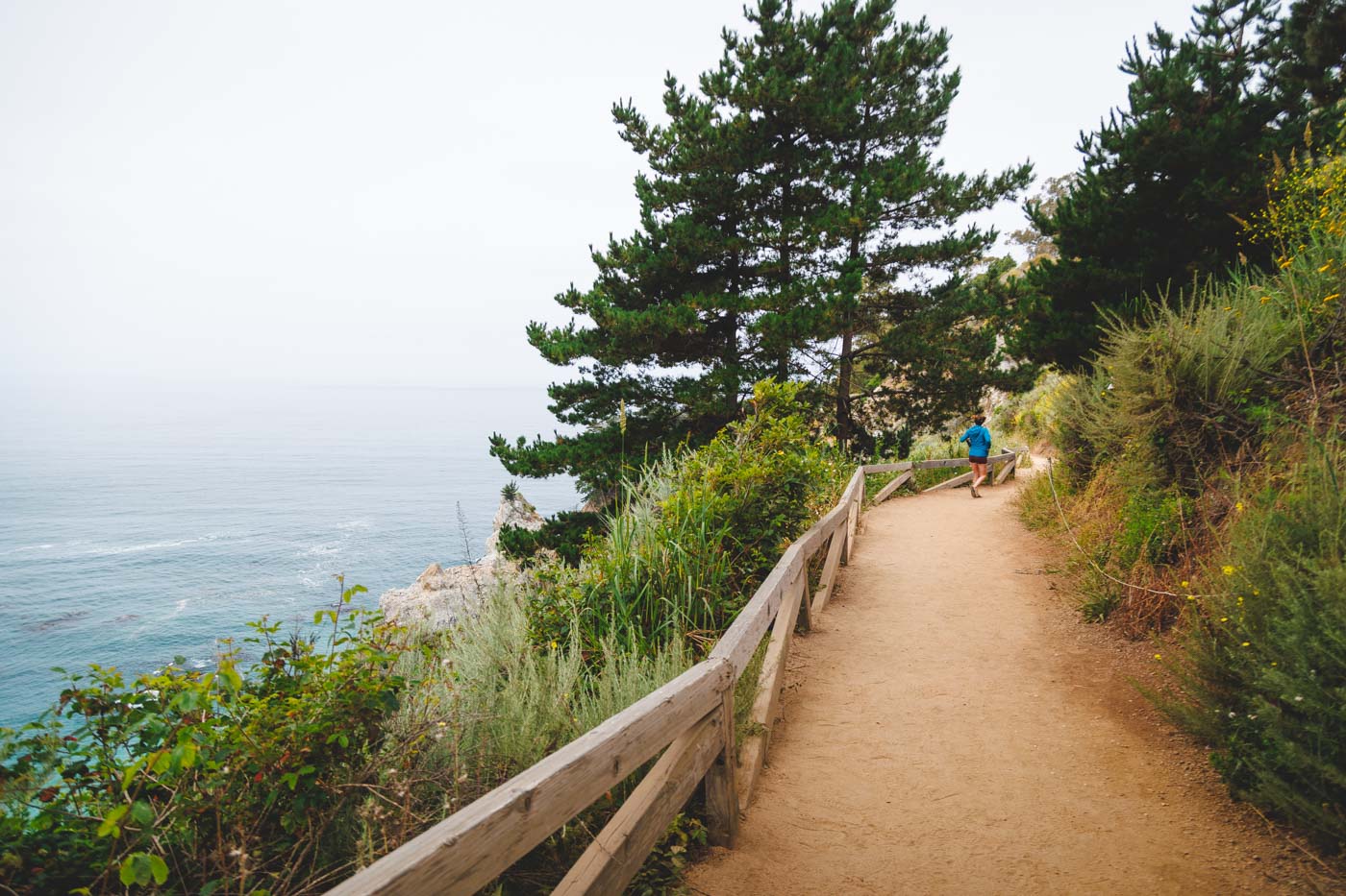
Important: The Overlook Trail has been closed for a long-term retaining wall repair. While it’s closed, you can still see McWay Falls from a small roadside viewing area along Highway 1 near the park entrance. Check the Julia Pfeiffer Burns State Park page for the current status before you go.
Can You Go Down to McWay Falls?
Nope. There’s no trail down to the beach, and going past the fences is illegal (and dangerous). The cliffs are crumbly and the surf is strong. The view from above is the whole experience, and honestly, it’s more than enough.

Where to Stay Near McWay Falls
Staying in Big Sur puts you closest, with everything from campgrounds to splurge-worthy lodges, but it books up fast. Carmel-by-the-Sea and Monterey have more options about an hour north, and Cambria is the best base heading south.
Where to Stay Near McWay Falls
🏨 Need a place to crash nearby?
From rustic cabins to boutique inns—check prices and availability in just a click.
Best Time to Visit McWay Falls
- Time of day: Early morning and late afternoon have the fewest crowds and the softest light. Sunset here is magical.
- Time of year: The falls flow year-round, but they’re strongest in winter and spring after the rains.
- Whale season: Keep an eye on the ocean from December through April for migrating gray whales.

More to Do Nearby
- Partington Cove: Just north of McWay, this short, steep trail drops through a canyon and a rock tunnel to a hidden cove. Read our guide to the Partington Cove Trail.
- Ewoldsen Trail: A redwood-filled loop from the same parking lot, with big ocean views at the top. Parts of it have been closed after storms, so check before you go.
- More Big Sur hikes: See our favorite hikes in Big Sur.
- Lunch with a view: Nepenthe, a few miles north, is a Big Sur classic.
Tips for Visiting McWay Falls
- Check Highway 1: Big Sur’s stretch of Highway 1 is prone to closures from storms and landslides. Check Caltrans QuickMap before you go.
- Fill up first: Gas is limited and pricey in Big Sur. Fill up in Carmel or Monterey (heading south) or Cambria (heading north).
- Pack snacks and water: There are restrooms and a few picnic tables at the parking area, but no food.
- Don’t fly a drone: Drones aren’t allowed in the state park.

Final Thoughts
McWay Falls is a quick stop, but it’s one you’ll remember forever. Pair it with Partington Cove and a few more Big Sur viewpoints for a perfect day on Highway 1.
Read more of our guides from around Big Sur:
- Things To Do in Big Sur: 16 Best Stops on a Big Sur Drive
- 9 BEST Hikes in Big Sur
- Guide to Garrapata State Park
- McWay Falls in Big Sur
- Partington Cove Trail in Big Sur
- 14 BEST Things to Do in Cambria
- 16 BEST Things to Do in Morro Bay
- 12 Marvelous Things To Do in Monterey
- 25 Best Things to Do in Carmel-By-The-Sea