Guide to Garrapata State Park in Big Sur, CA
We wouldn’t blame you if you had never heard of Garrapata State Park.
Not a huge number of people know about this stunning Highway 1 destination. You could easily cruise along the highway and miss it completely; with limited signage, it is a hidden gem looking to stay that way.
Covering around 3000 acres, Garrapata State Park sits at the base of the Santa Lucia Mountain Range, covering visibly spectacular rocky beaches, coastal bluffs, inland canyons, redwood groves, and towering mountain peaks.
Seals, sea lions, whales, tons of mammals, and even more birds frequent the lands and waters, and magical attractions like the Calla Lily Valley make this a pretty special park!

Table of Contents
Garrapata State Park—Hikes and Beach!
We absolutely love this state park and think it’s a great stop while driving Big Sur! If you’re driving north to south, you’ll find Garrapata State Park just outside of Monterey and Carmel-by-the-Sea.
There are several hikes, but we listed the main/best four hikes below including the trail to the beach!
The Bluff Trail
Distance: 0.5 miles
Type of Trail: Out & Back
Difficulty: Easy
Elevation Gain: 36 feet
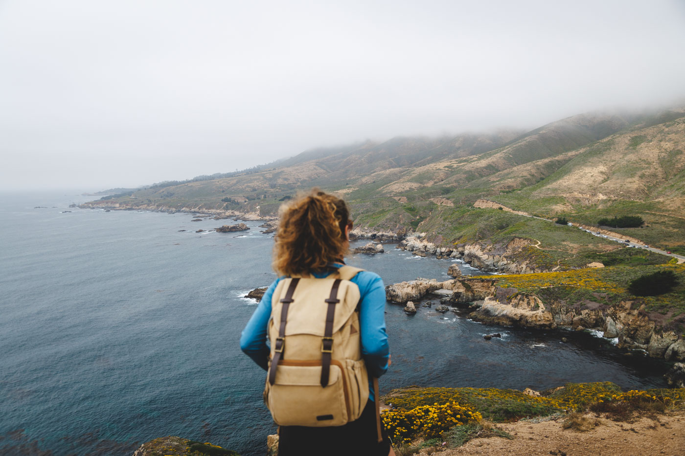
There are plenty of trails in Garapatta State Park, but take the Bluff Trail for a short but cool hike. The coastline along the Big Sur is stunning, but these views are extraordinary. You’ll be greeted by incredible views no matter where you look when you’re walking.

Look to the west to see the crashing waves of the Pacific Ocean; to the east, you’ll see the Santa Lucia Mountains rising majestically up out of the water. Soberanes Point stands proud in the south, with the Garrapata cliffs down to the north.
Because of how easy and quick this coastal hike is, it is one of the more trodden trails within Garrapata State Park. Wildflowers and cypresses share the trail with you, plenty of birds fly overhead, and the fenced scenic overlooks provide the perfect place to snap a photo or two.

Soberanes Point and Whale Peak (Our Fav Hike!)
Distance: 1.6 miles
Type of Trail: Loop
Difficulty: Easy
Elevation Gain: 269 feet
For even more incredible views at Garrapata State Park, you can add the Soberanes Point and Whale Peak Loop to the Bluff Trail.
If you have the time, it is definitely worth the extra mileage, as Soberanes Point is one of the most stunning vistas along the Big Sur coastline, and with many incredible views on this stretch of coast, that is certainly saying something. Once you reach the point, there are a few tempting side trails if you are looking to explore more.


After following the Bluff Trail, continue the route south down to Soberanes Point, heading around Whale Peak. Once you have taken your fill of the rugged coastline vista, continue the climb up to Whale Peak.
Whale Peak is nothing more than a small hill, making the climb short and sweet, but the views are no less magical when you reach the top.

For a hike that is only a couple of miles long, it packs a lot of punch, with clifftop vistas, rocky views, wildflowers, and even the potential to spot wildlife and have it all to yourself.
Soberanes Canyon Trail (Continuation to Doud Peak)
Distance: 2.8 miles (6 miles)
Type of Trail: Out & Back
Difficulty: Moderate (Hard)
Elevation Gain: 505 feet (1,876 feet)
Although the coast is the main draw here, the inland landscapes are not bad either! As most people choose to stick more towards the ocean and cliff at Garrapata State Park, your venture down Soberanes Canyon Trail will likely be quiet and peaceful.

You will start the hike walking through a mountain valley, with the grounds around you covered in wildflowers in the spring. In less than an hour, your whole surroundings change, and suddenly, you will be hiking through thick rainforests, surrounded by giant redwoods and thick flora and fauna!

If you want to add some mileage to the Soberanes Canyon Trail, you can continue making your way up to Doud Peak.
The trail starts nice and easy and shaded through the canyon, surrounded by cacti, redwoods, flowers, and steams, but as soon as you are out of the canyon and begin the climb up to the peak, things get a little more challenging.

If you are lucky enough to visit on a clear day without the fog, the views from the peak are breathtaking, allowing you to gaze over the Big Sur landscape and the incredible Pacific Ocean.
Garrapata Beach and Calla Lily Valley
Distance: 0.9 miles
Type of Trail: Loop
Difficulty: Easy
Elevation Gain: 91 feet
This trail may be slightly removed from the rest of Garrapata State Park, but it is well worth it for the beach and flowers along the route.

Although this short hike is spectacular no matter what time of year you visit, in the spring, the area comes alive with brightly colored wildflowers, especially in Calla Vily Valley, where the whole area is covered in stunning calla lily blooms. You should also try to visit during low tide if you want to be able to explore the beaches.

The hike first takes you down the ravine where the flowers are, and we recommend wearing long pants to avoid the poison oak! Cross the small stream that runs down to the ocean and traverse the cliffs to get some incredible views of the beaches and cliffs, which you can always get down and explore further.
Be prepared for mud and crowds in the valley, but we think it’s worth it!
Read more of our guides from around Big Sur:
- Things To Do in Big Sur: 16 Best Stops on a Big Sur Drive
- 9 BEST Hikes in Big Sur
- Guide to Garrapata State Park
- McWay Falls in Big Sur
- Partington Cove Trail in Big Sur
- 14 BEST Things to Do in Cambria
- 16 BEST Things to Do in Morro Bay
- 12 Marvelous Things To Do in Monterey
- 25 Best Things to Do in Carmel-By-The-Sea
We hope this helped you plan your visit to Garrapata State Park!