17 Best Hikes in San Francisco to Tackle
Hikes in San Francisco may not be your first thought when thinking of the city, but you will be surprised at how many epic trails wind their way around the Golden Gate Bridge, Marin Headlands, Mount Tamalpais State Park, and even some in the city itself.
There are hikes for all abilities, taking you along cliffs, hidden waterfalls, up hills to incredible viewpoints, through forests of towering redwoods, and so much more. Let’s look at some of the best hikes in San Francisco!
Table of Contents
Hikes in San Francisco with City Views
You don’t have to go far to get up high and take in the views!
1. Philosopher’s Way
Distance: 2.3 miles
Type of Trail: Loop
Difficulty: Easy
Elevation Gain: 328 feet
The Philosopher’s Way Loop sits in McLaren Park and is well-marked, with plenty of parking and multiple starting points. Essentially, the trail loops around the park’s perimeter, built to inspire contemplation, with 17 ‘musing stations,’ a unique feature not commonly found in the trail system.

The stations are marked with rocks, and the area aims to highlight the interrelationships between the area’s ecology, geography, and history.
If you want to extend your mileage, plenty of other trails come off the loop to help explore the park further.
2. Corona Heights Trail
Distance: 0.6 miles
Type of Trail: Loop
Difficulty: Moderate
Elevation Gain: 144 feet
Get some of the best views of the San Francisco cityscape on the short and sweet Corona Heights Trail. The trail allows you to enjoy the great outdoors while within the heart of the city.
Take the well-marked trail up to a 360-degree overlook of the incredibly scenic city. Although short, the course is fairly steep, with some dirt steps to help you up.

If you visit the trail in spring, you will be greeted with a sea of wildflowers around your feet, which adds to the appeal of this popular trail. Plenty of parking at the trailhead means you can easily slip this walk into a lunch break or between attractions without stress.
3. Twin Peaks Loop
Distance: 2.1 miles
Type of Trail: Out & Back
Difficulty: Easy
Elevation Gain: 272 feet
Take the hike up to the twin peaks if you are looking for hikes in San Francisco with a view!
The peak sits 922 feet in elevation and is at the geological center of the city. You’ll get some incredible views of the Bay Area and further afield. The peaks were once known as Los Pechos de la Choca, and to save you from translation, it means Breasts of the Maiden; hopefully, we don’t have to explain why!

You could start the hike from anywhere, not just the trailhead and wind around the peaks, giving you 360 views of the city stretching out around you. Although it is a bit of a climb, plenty of paved paths up to the summit make the going a little easier.
4. Bay Area Ridge Trail and the Golden Gate Bridge to Marin Headlands
Distance: 1.7 miles
Type of Trail: Point to Point
Difficulty: Easy
Elevation Gain: 239 feet
You can’t get much more of an iconic hike in San Francisco than one that takes you across the Golden Gate Bridge. Start this hike at the South Parking Lot and walk towards the bridge.
There may be fog, traffic noise, and many tourists, but you are walking across one of the most famous landmarks in the world!

As you walk north, take in the views of the Marin Headlands, and keep your eyes peeled for whales, dolphins, and pelicans. On the way back across the bridge, the city’s views will blow you away.
If you are up for a bit more of a hike, walk down to Hendrik Point on the north side for a stroll around the batteries or the path down to Fort Point on the south side.
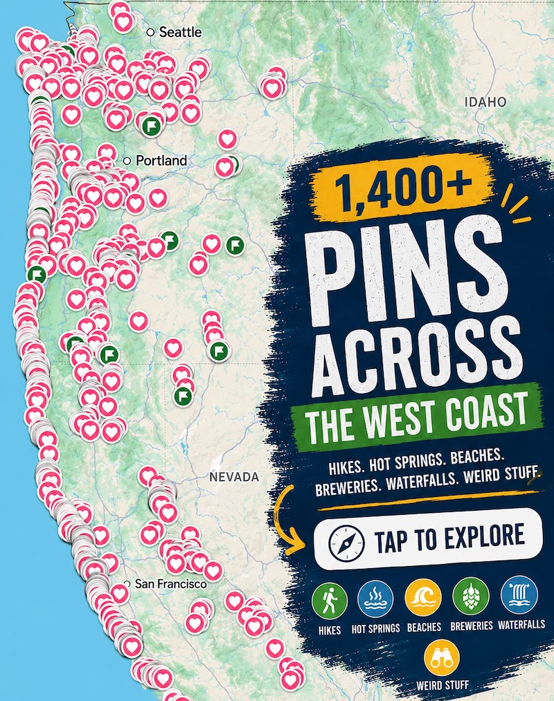
📍 GET THE ULTIMATE CALIFORNIA MAP 🗺️
Get our curated list of the best adventures and things to do north of LA loaded onto your maps with just two clicks!
✅ Waterfalls ✅ Hikes ✅ Viewpoints
✅ National Parks ✅ 1400+ Pins

🏨 Need a place to crash nearby?
From rustic cabins to boutique inns—check prices and availability in just a click.
Hikes in San Francisco’s GGNRA
About a half hour from San Francisco
This area is insanely massive and, if we’re being honest, confusing. But it does have some great hikes in San Francisco!
Don’t forget to read our full guide: Golden Gate National Recreation Area: What to Know
5. Rodeo Beach to Hill 88
Distance: 4 miles
Type of Trail: Out & Back
Difficulty: Moderate
Elevation Gain: 1043 feet
Follow the coastal trail from Rodeo Beach up and along the bluffs to start this trail. Slowly, as you make your way further inland, the cries of the gulls and the seals will begin to quiet as you climb.

Hill 88 towers above the beach, and as you make your way up, up, up, you will pass Battery Townsley and ascend Wolf Ridge, with a few additional spur trails taking you to viewpoints and other historical landmarks.
Around 50% of the trial is paved, and some stairs help you along some of the steeper parts. Once you reach the crest of the hill, on a clear day, you may be lucky enough to see as far as the Farallon Islands and Pedro Point.
6. Kirby Cove
Distance: 3 miles
Type of Trail: Out & Back
Difficulty: Easy
Elevation Gain: 610 feet
Kirby Cove is a bit of a hidden gem and one of the best hikes in San Francisco, loved by locals and visitors alike.

To the North of the Golden Gate Bridge in the Marin Headlands, you can make your way down the hillside on the Kirby Cove hike, accompanied by views of San Francisco, down to the course brown sands of the neat little cove. You will pass Golden Gate Vista Point, a short side trail out to Battery Spencer and Kirby Cove campsite.

Kirby Cove itself is a great place to sit and relax, drink in the views of the bridge and city, stroll along the sand, admire Battery Kirby, and, if you are in the right place at the right time, take a ride on the iconic swing that only sometimes makes an appearance on the beach.
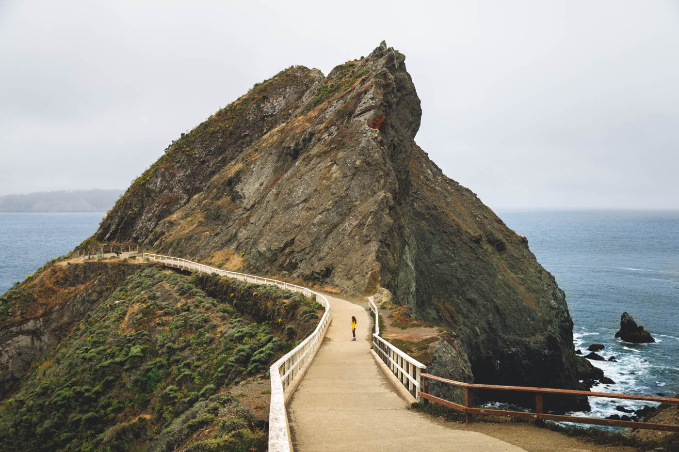
7. Point Bonita Lighthouse
Distance: 1 mile
Type of Trail: Out & Back
Difficulty: Easy
Elevation Gain: 203 feet
Point Bonita is an incredible lighthouse in the Marin Headlands; getting there is half the fun.
Admire stunning ocean views and rugged cliffs as you take the Point Bonita Lighthouse hike from the parking lot and along this steep and winding trail. Admire the basalt rock formation, brightly colored wildflowers in the spring, and dramatic cliffs along the way.


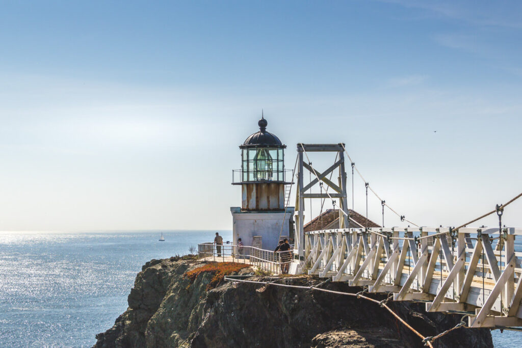
This active lighthouse is rich in history, and when it is open, you can cross the suspension bridge to the rick that houses the light. There are a few interesting exhibits that will tell you more about the lighthouse’s history and some epic views of the cliffs.
8. Lands End Trail
Distance: 3.4 miles
Type of Trail: Loop
Difficulty: Moderate
Elevation Gain: 551 feet
One of the best hikes in San Francisco is the Lands End Trail. It has a little bit of everything. For a start, you will be able to take in the majestic Golden Gate Bridge from multiple different angles, but it also offers so much more than that.
You can also check out the Sutro Baths for some history, the USS San Francisco Memorial, and Mile Rock Lighthouse.

From Land’s End Point, you can take a short walk down to Mile Rock Beach before returning to the main trail and continuing on a magnificent cliff-top walk through both dark groves of cypress trees and wide-open grasslands.
🕒 Save hours of planning time! ⛰️
📍 Get The Ultimate West Coast Map
1400+ breweries, trails, waterfalls, beaches, and weird roadside stops—mapped for you!
9. Batteries to Bluffs Trail
Distance: 2.3 miles
Type of Trail: Loop
Difficulty: Easy
Elevation Gain: 446 feet
The Batteries to Bluffs Trail is one of the more well-known trails for those hiking near San Francisco. You can’t get much better when it comes to views, with wide visits out over the Marin Headlands. The trail is short and sweet. You’ll twist and turn, climb and descend the coastal hills, passing wartime defensive structures along the way.

The best part is when you reach the beach, which offers jaw-dropping views of the Golden Gate Bridge. Be aware that there are 470 steps along the trail, both up and down, so it is a bit of a leg burner but well worth the effort.
Battery Crosby is the main attraction along the path, but you can always add on Battery West and Battery Godfrey if you need more history.
10. Crissy Field and the Palace of Fine Arts
Distance: 3.9 miles
Type of Trail: Loop
Difficulty: Easy
Elevation Gain: 32 feet
The vast open space of Chrissy Field is a wonder to walk around. You’ll find people from all walks of life walking, jogging, bird watching, cycling, and playing in the area before heading down to the beach to relax.
This hike offers one of the best ways to take it all in as you walk along the paved and dirt path. Views of San Francisco Bay, the Golden Gate Bridge, and the city will be with you every step of the way.

The detour to the Palace of Fine Arts is a highlight of the trail. The building is a work of art, with tall columns and a domed rotunda; you would be mistaken for thinking you have somehow ended up in Rome. Finish the hike back and rest on one of the best Golden Gates beaches in the area!
Hikes in Point Reyes National Seashore
About one to two hours from San Francisco, depending
Don’t forget to read our full guides:
- 16 Things to Do in Point Reyes National Seashore
- 9 Must-Do Hikes in Point Reyes National Seashore
- 11 Stunning Beaches in Point Reyes Worth Visiting
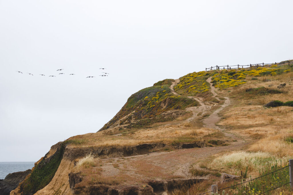
11. Alamere Falls via Coast Trail from Palomarin Trailhead
Distance: 13.7 miles
Type of Trail: Out & Back
Difficulty: Hard
Elevation Gain: 1,817 feet
This long but incredible trail takes you through the Philip Burton Wilderness Area to Alamere Falls.
You will encounter spectacular ocean views for most of the hike, where on a clear day, you can see the Farallon Islands, cross varying terrain, and pass some beautiful lakes such as Bass Lake, Pelican Lake, and Wildcat Lake.
Some people enjoy stopping and taking a dip in Bass Lake as a break from all the hiking!

When you finally reach Alamere Falls, you’ll realize why many people choose this journey. The hike takes you down to the bottom of the falls, where the water cascades down the 40-foot cliff onto the south end of Wildcat Beach.
12. Chimney Rock Trail
Distance: 1.8 miles
Type of Trail: Out & Back
Difficulty: Easy
Elevation Gain: 160 feet
The incredible Chimney Rock Trail is often overlooked, which means you have a good chance of having a much quieter hike compared to some of the other, more well-known trails for hiking near San Francisco.
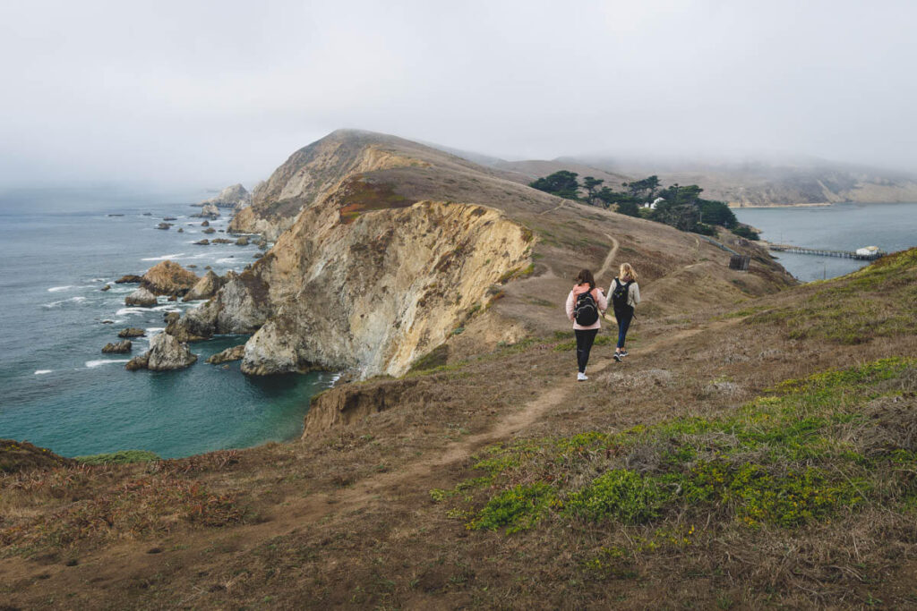


The hike is a steady climb upwards, although it levels off towards the end, taking you along blustery grasslands along the bluffs, all the way out to the overlook of Chimney Rock, the elephant seals down below, and the famed old lifeboat station.
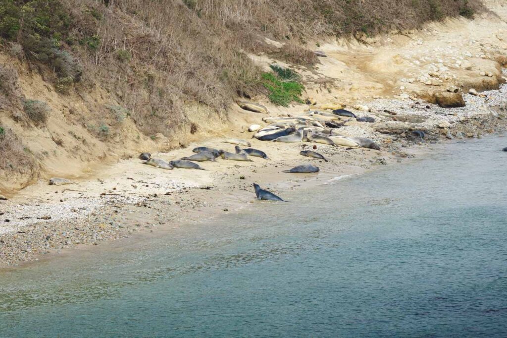
Tons of seabirds like gulls and black oystercatchers flock to the rocks below, and you have an incredible vantage point of Drakes Bay and the hulking shape of Mount Tamalpais.
13. Tomales Point Trail
Distance: 9.5 miles
Type of Trail: Out & Back
Difficulty: Moderate
Elevation Gain: 1,200 feet
It is worth braving the potential fog and wind to tackle the Tomales Point Trail. It is quite a long one, and there is a fair amount of elevation gain, but along the way, you can take in views of Tomales Bay and Bodega Bay and have a great chance of spotting some of the local wildlife from your lofty vantage point.

Part of the trail takes you through the Tule Elk Reserve, so your chances of spotting some of these majestic creatures are relatively high.
You can turn around at any point on the trail and still be satisfied with the incredible vistas, but we recommend making it to the tip of Tomales Point. However, be mindful of potential hazardous cliffs and unstable ground. If you time it right, you will be treated to a beautiful sunset on your way back.

More on the hikes we love in Point Reyes:
- Abbotts Lagoon Trail in Point Reyes National Seashore
- Chimney Rock Trail in Point Reyes National Seashore
- Point Reyes Lighthouse in Point Reyes National Seashore
Hikes in Mount Tamalpais
About one hour from San Francisco
If you want the most perfect blend of verdant forests to explore and epic coastal views, then hiking around Mount Tamalpais is the place to do it.
Don’t forget to read our full guide: Uncovering Mount Tamalpais State Park Near San Francisco
14. Dipsea Trail to Steep Ravine Trail to Matt Davis Loop Trail
Distance: 6.7 miles
Type of Trail: Loop
Difficulty: Moderate
Elevation Gain: 1,699 feet
This trail takes you to some of the best spots that Mount Tamalpais has to offer. Start the hike from the Pacific Ocean in Stinson Beach, climbing up the rolling hills to Pantoll Ranger Station.
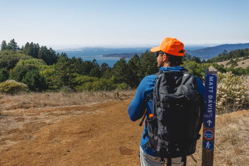

The hike is unique and beautiful, with ocean views quickly replaced with steep, lush canyon walls covered in dense forests and giant redwood trees. It doesn’t stop there, as there are two spectacular waterfalls to enjoy as a bonus, one of which requires the climbing of a small ladder to view.
15. Verna Dunshee Trail and Plank Trail at Mount Tam East Peak
Distance: 1.3 miles
Type of Trail: Loop
Difficulty: Moderate
Elevation Gain: 275 feet
This twisting trail is almost a double loop. Although you can do this hike in San Fransico in any order, you might as well get the climb out of the way first.
Park your car at the East Peak Parking Lot and start the short ascent up to Mount Tam East Peak; it is quick and sweet but not without a steep scramble.
After a few switchbacks, you’ll reach the summit, with incredible views of San Fran, the Richmond Bridge, and the rolling hills surrounding you.

Before heading back to your car, after heading back down, take the Verna Dunshee Trail that loops around the peak, complete with incredible viewing platforms, narrow bridges, and even the Gravity Railroad Museum.
Hikes in Muir Woods
About one hour from San Francisco
This is one of the most incredible areas to go hiking in San Francisco! If you want to wander deep into redwood forests, this is the spot.
Don’t forget to read our full guide: 5 of The Best Hikes in Muir Woods
16. Muir Woods Ben Johnson to Dipsea Trail Loop
Distance: 4.1 miles
Type of Trail: Loop
Difficulty: Moderate
Elevation Gain: 971 feet
Make your way through Muir Woods National Monument on this epic trail. The trail has the best of all aspects of the park.
You will start by hiking the Fern Creek and Hillside Trails, with the towering redwoods accompanying you most of the way. You won’t be able to get over the size of these trees when you see them for the first time.

Around the two-mile marker, you will join the Dipsea Trail, which is slightly different from the forest-filled start. This part of the Dipsea Trail offers glimpses of the surrounding landscapes.
At this stage, there is also a good chance you will have lost the crowds, so you can enjoy the trail without bumping into other hikers.
17. Fern Creek to Camp Eastwood to Lost to Canopy Loop
Distance: 3.9 miles
Type of Trail: Loop
Difficulty: Moderate
Elevation Gain: 820 feet
Starting at the Muir Woods Visitor Center, this trail will take you through some of Muir Wood’s highlights as you navigate the loop of Fern Creek, Camp Eastwood, Lost, and Canopy Trails.

Throughout the loop, you will have plenty of opportunities to take in the majestic redwoods the park is known for, with shade to keep you cool on the hotter days.
If you prefer tackling the hills first, take the hike counterclockwise and enjoy a gradual descent on the way down. Hiking near San Francisco does not get much better than this.
We hope this helped you plan which hikes in San Francisco to tackle!