
Devil’s Slide Trail: Everything You Need to Know
For decades, Highway 1 kept sliding into the ocean on this stretch of cliffs south of Pacifica. Then California built tunnels through the mountain and handed the old road over to walkers and bikers.
Now the Devil’s Slide Trail is one of the easiest and most scenic walks on the San Mateo coast. It’s paved, mostly gentle, and has huge ocean views, nesting seabirds, and an old military bunker perched on the cliffs. It’s the perfect leg stretcher on a coastal road trip.
📌 BEFORE YOU GO
- Where: Highway 1 between Pacifica and Montara, on the old road next to the Tom Lantos Tunnels
- Parking: Free lots at both ends. They open at 8 a.m. and close between 5 and 8 p.m. depending on the season, and fill up fast on weekends
- Trail: 1.3 miles each way, fully paved
- Dogs: Leashed dogs are welcome, and bikes are allowed too
- Tours: San Francisco and Marin tours
🏨 Where to stay: Pacifica (5 minutes north) · Half Moon Bay (20 minutes south) · San Francisco (about 30 minutes)
Where Is the Devil’s Slide Trail?
The Devil’s Slide Trail is on Highway 1, about 2 miles south of Pacifica and 15 miles south of San Francisco. It follows the old highway around the cliffs, while cars now zip through the Tom Lantos Tunnels inside the mountain.
There’s a parking lot at each end. The smaller north lot is only reachable when you’re driving south on Highway 1. The larger south lot, just past the tunnels, works from either direction. Both are free and have restrooms.
The lots open at 8 a.m. and close at 5 p.m. in winter, pushing later as the days get longer, up to 8 p.m. in summer. Parking is tight, so come early on weekends.
📍 GET THE ULTIMATE CALIFORNIA MAP 🗺️
Get our curated list of the best adventures and things to do north of LA loaded onto your maps with just two clicks!
✅ Waterfalls ✅ Hikes ✅ Viewpoints
✅ National Parks ✅ 1400+ Pins
Why Is It Called Devil’s Slide?
For good reason! The trail hugs a steep cliff between San Pedro Mountain and Montara Mountain. The rock here is weak and crumbly, and the Pacific pounds the base of the cliff all year, so landslides were constant.

People tried to tame Devil’s Slide for over a century. A railroad was built along the cliffs in the early 1900s, but it was damaged by slides after the 1906 earthquake and shut down in 1920.
Highway 1 was cut into the hillside in 1937, and it didn’t fare much better. Landslides closed the road again and again, including a long closure in 1995 and another in 2006.
Finally, the Tom Lantos Tunnels opened in 2013, bypassing the cliffs completely. San Mateo County Parks turned the old road into the Devil’s Slide Trail, which opened in 2014.
Walking the Devil’s Slide Trail
Distance: 2.6 miles round trip
Type of Trail: Out and back
Difficulty: Easy
Elevation Gain: About 300 feet
The trail is the old highway, so it’s wide, smooth, and paved. Walkers, runners, bikers, and even the occasional horse rider share it, and there’s plenty of room for everyone.

Honestly, this is more of a walk than a hike. I walked it in flip-flops because that’s what I’m most comfortable in! That’s how easy it is.
That said, there are a few steeper stretches where the old road climbs. You’ll feel them on the way back, so take your time.
Highlights of the Devil’s Slide Trail
The Rugged Coast
The views are the whole point. Waves smash into the rocks below, and there are benches and viewing scopes along the way so you can stop and take it all in. On a clear day, you can see north past Pacifica toward Marin.

🏨 Need a place to crash nearby?
From rustic cabins to boutique inns—check prices and availability in just a click.
Seabirds on the Cliffs
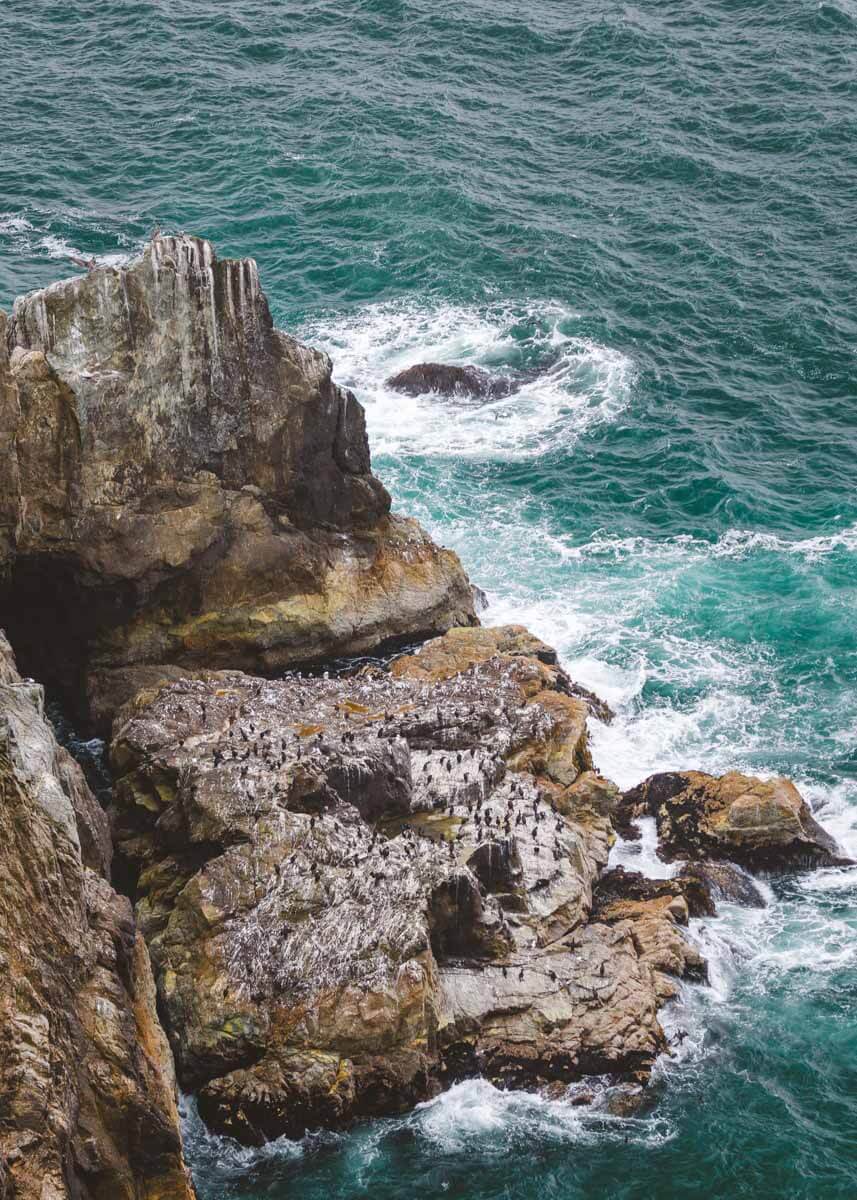
The cliffs above and below the trail are nesting grounds for tons of seabirds. Look for common murres, pigeon guillemots, cormorants, and western gulls. Peregrine falcons nest here too, so keep an eye on the sky.

Whales and Marine Life
The trail is a great perch for whale watching. Gray whales pass by heading south in December and January, then head back north from about March to May. Humpbacks feed off this coast from spring through fall.
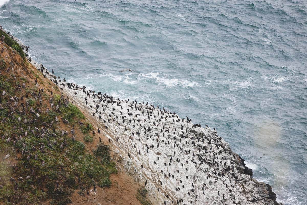
Look closer to shore and you might spot harbor seals or sea lions on the rocks too.
The Old Military Bunker
Near the south end of the trail, you’ll see a concrete bunker sitting on a rocky ledge above the ocean. It was part of the coastal defense network built around San Francisco during World War II, and today it’s covered in graffiti.
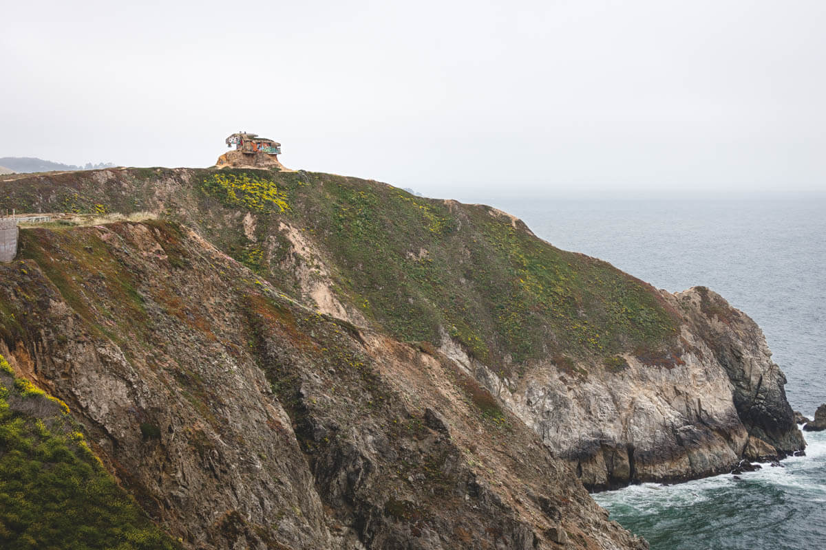
It’s a cool sight from the trail, but the cliffs around it are crumbly and unstable, so enjoy it from a distance.
Once you’ve walked the trail, there’s plenty more to explore just down the coast in Half Moon Bay.
Make a weekend of it on the coast.
Where to Stay Near Devil’s Slide
Pacifica is the closest town, just 5 minutes north, with a handful of hotels right on the beach. Half Moon Bay, about 20 minutes south, has a lot more choice, from cozy inns to oceanfront resorts.
Want more space? A vacation rental on the coast is great for families and groups. Or base yourself in San Francisco and make Devil’s Slide an easy day trip.

Where to Stay Near Devil’s Slide
Tips for Walking the Devil’s Slide Trail
- Go early: Both lots are small and fill up quickly on sunny weekends.
- Watch the clock: The parking lots close in the evening, as early as 5 p.m. in winter, so don’t start a sunset walk too late.
- Bring layers: It’s often windy and foggy here, even in summer.
- Pack binoculars: They make spotting whales and nesting birds way easier.
- Stay on the trail: The cliffs are unstable, so don’t climb past the railings.
🕒 Save hours of planning time! ⛰️
📍 Get The Ultimate West Coast Map
1400+ breweries, trails, waterfalls, beaches, and weird roadside stops—mapped for you!
More to Explore Nearby
Right at the south end of the trail is Gray Whale Cove State Beach, a pretty little beach tucked below the cliffs. A bit farther south, Montara State Beach is great for tide pooling and beach walks.

Heading north? Stop at the Pacifica Taco Bell. Yes, really. It’s right on the sand at Pacifica State Beach and might be the coolest Taco Bell in the world. It’s perfect for refueling and surfer watching.
Heading south, check out our guides to things to do in Half Moon Bay, the best beaches in Half Moon Bay, and hikes in Half Moon Bay.
FAQs About the Devil’s Slide Trail
The trail is 1.3 miles each way, so it’s about 2.6 miles round trip between the north and south parking lots.
Yes, it’s the old Highway 1, so it’s fully paved and wide, which makes it great for walkers, strollers, and bikes.
Yes, leashed dogs are allowed on the trail.
The parking lots open at 8 a.m. every day and close between 5 p.m. in winter and 8 p.m. in summer, depending on the time of year.
Yes, there are small free lots at both ends. The north lot is only reachable driving southbound, while the larger south lot works from either direction.
Final Thoughts
The Devil’s Slide Trail is one of the easiest ways to get big Pacific views near San Francisco. It’s short, paved, and full of history, with seabirds, whales, and a bunker on the cliffs to keep things interesting.
Go early to grab parking, bring a jacket, and make a day of it with Pacifica or Half Moon Bay.
Read more of our guides to San Francisco and nearby:
- 17 Best Hikes in San Francisco to Tackle
- 15 Best Golden Gate Bridge Viewpoints
- 12 Stunning Golden Gate Beaches to Visit
- Golden Gate National Recreation Area: What to Know
- Kirby Cove: Everything You Need to Know
- Mount Tamalpais State Park Near San Francisco
- 5 of The Best Hikes in Muir Woods
- Devil’s Slide Trail: Everything You Need to Know
- 16 Things to Do in Point Reyes National Seashore
- 17 BEST Things to Do in Half Moon Bay
We hope you enjoy walking the Devil’s Slide Trail during your visit!