10 Best Hikes in Half Moon Bay, California
The hikes in Half Moon Bay have a little bit of everything for all sorts of hiking skill levels. Just because it’s a sleepy beach town doesn’t mean it doesn’t have a lot to offer!
With so many different hikes in various locations down the coast, it can be challenging to make up your mind about which will be the best for you.

The good news is, you can’t make a bad choice; all of the hikes offer jaw-dropping views, tons of wildlife, interesting natural attractions, or a combination of all, so you can’t go wrong.
The Half Moon Bay Area is blessed with all types of settings, including sandy beaches, high windswept bluffs, marshes, ranch land, and towering redwoods, so it kinda has it all! Let’s get into it…
Don’t forget to check out our other guides to Half Moon Bay!
- 17 BEST Things to Do in Half Moon Bay, California
- 10 Most-Worth It Beaches in Half Moon Bay, California
1. Devil’s Slide Trail
Distance: 2.8 miles
Type of Trail: Out & Back
Difficulty: Easy
Elevation Gain: 344 feet
If you are only going to do one hike in the Half Moon Bay area, make it Devil’s Slide. It is undoubtedly one of the most epic hikes in Half Moon Bay, or the whole of California, filled with views, history, and something unique.

The route itself is relatively easy. It is not overly long or strenuous, but the views are some of the best you will get along this stretch of coast. This history side of the trail lies in the fact that as you walk, you will be hiking along the old Pacific Coast Highway.
Yes, people used to have to drive around the sides of the cliffs in vehicles. The road may have had expansive views, but it wasn’t without its dangers.

The trail is paved the entire way, making for a nice and easy walk, with the views getting better every time you take a step. Along the way, keep an eye out for old bunkers that were used in WWII.
As a multi-use trail, you may also be sharing the trail with horse riders and bikes, but there are separate lanes for walkers and cyclists, making it the perfect trail for families.
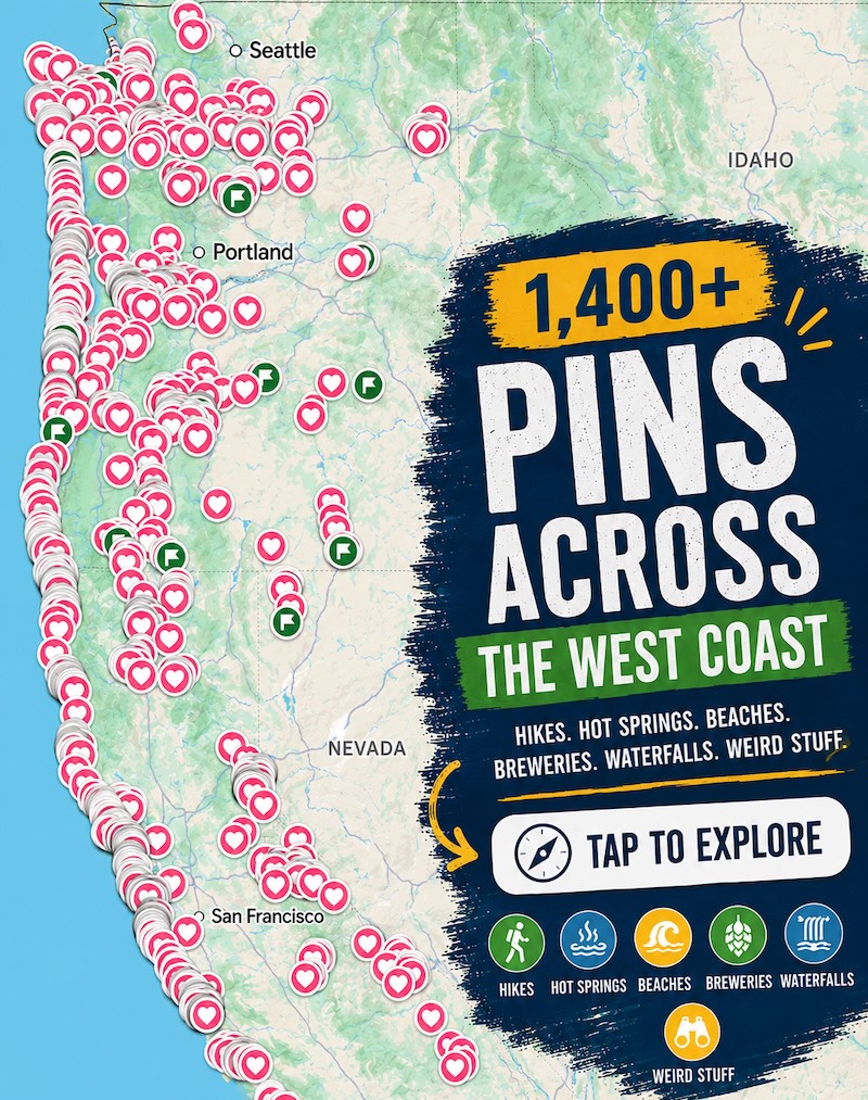
📍 GET THE ULTIMATE CALIFORNIA MAP 🗺️
Get our curated list of the best adventures and things to do north of LA loaded onto your maps with just two clicks!
✅ Waterfalls ✅ Hikes ✅ Viewpoints
✅ National Parks ✅ 1400+ Pins
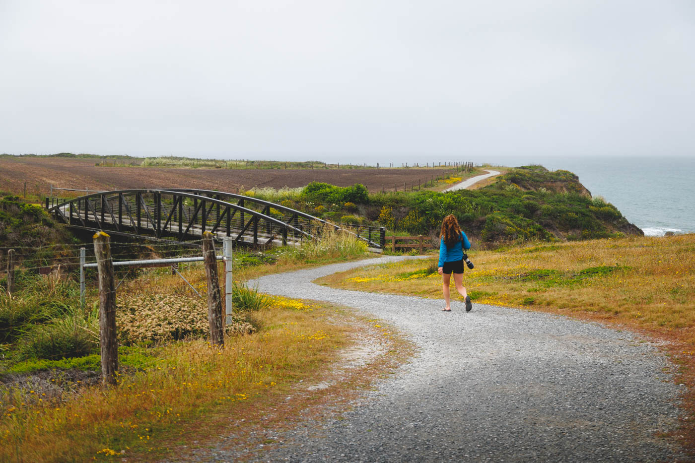
2. Half Moon Bay Coastal Trail
Distance: 3.8 miles
Type of Trail: Out & Back
Difficulty: Easy
Elevation Gain: 239 feet
The Half Moon Bay Coastal Trail takes you, you guessed it, right along the coast!
The trail hugs the bluffs for the majority of the route, and the fact that it is paved in some places and flat the majority of the way means you won’t run out of puff in a hurry. It is also pretty accessible, making it one of the more popular hikes in Half Moon Bay for families.

As you traverse the coast, look out for hidden beaches and coves, many of which can be reached relatively easily via a series of side trails that will take you down onto the sand. Just remember you still have to hike back up to the main trail.
Start the hike heading down the stairs to Cowel Roanch Beach and enjoy the chance to feel the sand between your toes. After spending a while on this stunning beach, continue hiking along the cliffs.

After a while, the trail widens and turns to concrete, and at this point, the trail gets a little more refined as you walk through the Ritz Carlton Golf Course, so look out for flying golf balls!
After the golf course, you’ll pass Manhattan Beach, Miramontes Point, and finally, Redondo Beach.
It is the hike of all hikes for beach hopping in Half Moon Bay.
3. The Cowell Purisima Trail
Distance: 7 miles
Type of Trail: Out & Back
Difficulty: Easy
Elevation Gain: 400 feet
The Cowell Purisima Trail is a long one, but it is worth it for every step of the 7 miles of this hike. Sandwiched between farmland and the ocean, there are stunning views no matter where you look.

As an out-and-back hike, you can choose two trailheads at either end of the trail, but most people will use the Cowell Ranch Beach Trailhead.
The whole hike is relatively flat, and the gravel path is pretty nice to walk on, with bridges over the marsh and the creek making things a little more interesting.

When looking out over the sea, keep your eyes peeled for seals that often bob around in the water below the bluffs.
4. Pillar Point to Mavericks Trail
Distance: 2- 3.6 miles depending
Type of Trail: Loop
Difficulty: Easy
Elevation Gain: 259 feet
This trail is one of the most well-known hikes in the Half Moon Bay area, and for good reason. The trail itself is easy to follow and very well maintained, and at under two miles, it’s a great trail for hikers of all abilities.

As you start the trail, you will immediately begin to head up the hill, and it won’t take long until you reach the very top of the bluff, and when you do, the vista will blow you away.
Looking out across the bluff, you can take in Ross’ Cove, Pillar Point Harbor, and the legendary Maverick’s surf break from a distance.
From high up on the bluff, you also have a good vantage point for whale watching. If you are visiting during the migration season, keep your eyes on the ocean, as you have a good chance of spotting some of these majestic creatures.

The short hike is great if you want to stretch your legs without going too far, but still take in some incredible views of the Half Moon Bay Coast.
You can continue along for a bigger loop and actually head to the pier to get a better view of the world-famous surfing waves at Mavericks.
✋ HOLD UP! Don’t Forget…
You need some wheels! It’s nearly impossible to get around the USA and check out the best adventures without a car! Here are our top recommendations…
🚗 Rent a car
If you don’t have your own, renting a car is your best bet!
🚐 Rent a home on wheels
For the more adventurous, rent a van or RV and ditch the hotel.
5. Fitzgerald Marine Bluff Trail
Distance: 0.8 miles
Type of Trail: Loop
Difficulty: Easy
Elevation Gain: 52 feet
The Fitzgerald Marine Bluff trail is a nice and easy loop that follows the shoreline and then back through a beautiful forest of cypress trees.
You get a lot of bang for your buck with this trail, as the views are stunning, and there are plenty of opportunities to stop for a picnic and take in the coastal vista for longer.

The old cypress grove offers plenty of shade, and in some parts, you’ll even enjoy almost a tunnel-like experience as the trees stretch out over the path. Wildlife is usually abundant on the trail.
Look to the skies for huge brown pelicans looking for their lunch or down to the ocean for the shiny head of bobbing seals.
If you have some spare time after walking the trail, you should head down to the Fitzgerald Marine Reserve and check out the tide pools for even more wildlife.

🏨 Need a place to crash nearby?
From rustic cabins to boutique inns—check prices and availability in just a click.
6. Gray Whale Cove Trail Loop
Distance: 1.9 miles
Type of Trail: Loop
Difficulty: Moderate
Elevation Gain: 465 feet
Take to the hills high above Gray Whale Cove and Montara State Beach on this short and sweet hike.
Although the whole hike is located high on a hill, there is relatively little elevation gain as you hike, so you are free to take in the views without trying to remember how to breathe.

Start the hike at the Montara State Beach and Whale Cove parking lot, where you will find plenty of parking available, and set out along the trail.
Although be aware that the weather can change by the minute here, some come prepared for all eventualities. Before long, you will head towards the ocean and get your first glimpse of the beach below.
The path runs parallel to Highway 1, following the edge of a mountain, before reaching an overlook of the beautiful Montara State Beach. If you are relaxing here for a while, don’t forget to scan the horizon for migrating whales!

If you are looking for a bit more of a challenge, you could always tackle one of the smaller side trails, such as the one that will take you to the peak of Montara Mountain or toward the Old Pedro Mountain Road.
7. Pigeon Point Lighthouse Trail
Distance: 0.3 miles
Type of Trail: Loop
Difficulty: Easy
Elevation Gain: 0 feet
The Pigeon Point Lighthouse Trail is a short and sweet stroll in Half Moon Bay, taking you to the impressive Pigeon Point Lighthouse.
Not only will you be able to get up close to the lighthouse, but the trail runs very closely to the edge of the cliff, offering incredible views out of the coast and beaches below.

Along the way, several interpretive panels give you an insight into the history of the local area.
If you are interested in finding out more about the towering lighthouse and its history, stop in at the visitor center for a ton of historical knowledge, plus the chance to see the old Fresnel lens up close. You will be shocked at quite how big it is!

If you are feeling adventurous, there is a path that will take you down to a small beach, and there are various lookout points that make for a great photo opportunity.
8. Sequoia Audubon Trail
Distance: 1.8 miles
Type of Trail: Out & Back
Difficulty: Easy
Elevation Gain: 65 feet
There is a lot to see on this out-and-back hike. You will start at the ocean, passing streams, grassland, and towering trees.
It has a little bit of everything while still being not too long. For the most part, the trail winds its way through Pescadero Marsh, where endangered Californian red-legged frogs may be lurking, as well as great egrets and a host of migrating butterflies.

It is one of the best hikes in the Half Moon Bay area to see sea birds as they make their home in the marsh and grasslands. More than 200 species of birds can be found here. It is a bird-watchers paradise.
From the beach, head towards the lagoon and a Sequoia Audubon Trail, walking under the bridge of Highway 1.
Sure, there are a lot more scenic hikes to be around, but it is the wildlife that’s the draw here, and you are sure to see a lot of it, from huge birds to tiny hidden creatures that scuttle around on more legs than you would want to count.

Check the trail before you head off, as sometimes there is some storm damage that takes the bridges out of use. There are a few side trails to explore as an alternative, so it is still a great area to venture to.
9. Atkinson Bluff and North Whitehouse Creek Trail
Distance: 2.3 miles
Type of Trail: Loop
Difficulty: Easy
Elevation Gain: 114 feet
This fantastic hike takes you on a scenic walk along the cliffs from Highway 1, all the way to Franklin Point.
The trail offers a bit of all worlds, with the bluffs a canopy of wildflowers in the spring and summer, seals and whales splashing around in the ocean, undulating dunes, and incredible views.

The path is sandy the majority of the way, so ensure you are wearing the proper footwear with plenty of ankle support to make things a little easier for you.
Once you reach Franklin Point, take in the views of the long, almost white sandy beach and the tall lighthouse standing majestically in the distance.
On your way back from Franklin Point, the end section of the hike is a loop that takes you down to the beach, where a little bit of climbing and rock scrambling is required to reach the sand below.
This hike near Half Moon Bay is actually in Ano Nuevo State Park, one of our favorite parks in the area!
10. Purisima State Park
Be prepared to get your hike on at Purisima State Park. With a 24-mile trail network within the preserve, there are plenty of paths to choose from.
The Purisima Creek Trail is one of the most popular hikes in the area, and seeing as it is downhill almost the entire way, you will have to ensure you store up some energy for the hike back up.
The elevation change is worth it though, as along the way you will be almost completely surrounded by the towering redwood trees the park is known for.

The Redwood Trail offers further redwood viewing, as you can never get enough of these incredible giants, which wind their way around the mountains and through the valley.
The Whittemore Gulch Trail is another incredible hike, offering the perfect combination of dense redwood-filled canyon and wide open hilltops that offer views over to the coast around Half Moon Bay.

Suppose you want a little bit of everything. In that case, the Purisima Creek Redwoods Loop is the one to choose, taking you on multiple hiking trails, such as the Whittemore Gulch, North Ridge, and Harkins Ridge Trails.
It then turns the hike into a very long but spectacular hike through the redwoods and mountains. If you have all day and want to see what the park offers, this is the hike.
👉 Accommodation in Half Moon Bay
Don’t forget to check out our other guides to Half Moon Bay!
- 17 BEST Things to Do in Half Moon Bay, California
- 10 Most-Worth It Beaches in Half Moon Bay, California
We hope this helped you plan which hikes in Half Moon Bay to tackle!