This California lake is twice as salty as the ocean, and Los Angeles nearly drained it dry
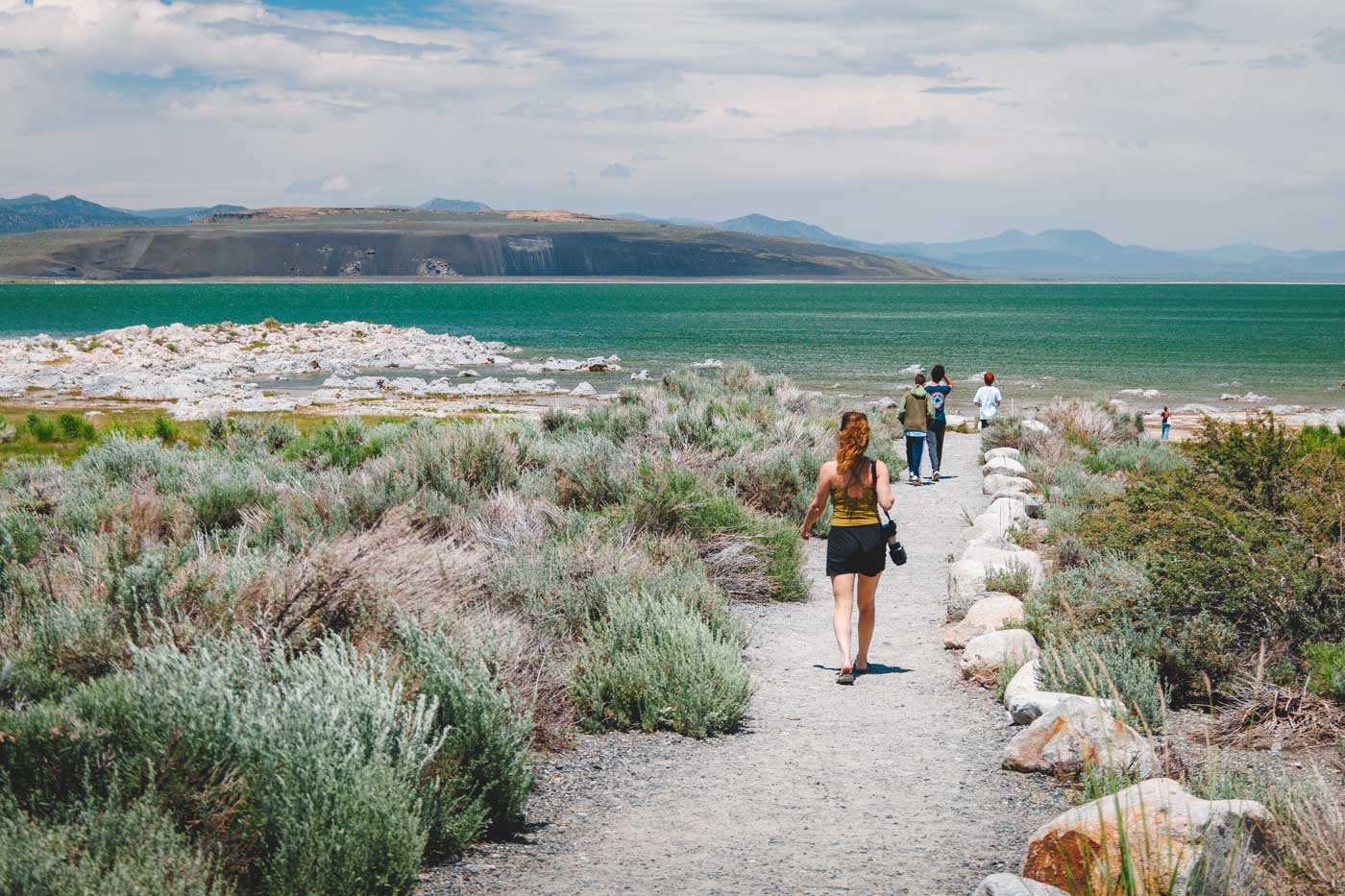
Mono Lake sits at the base of the Eastern Sierra looking almost otherworldly — glassy, mineral-blue water studded with limestone spires, and no fish swimming in it at all. That’s not an accident. At roughly two and a half times saltier than the ocean, this lake is inhospitable to fish and perfect for almost nothing else on Earth.
It’s also a lake that Los Angeles very nearly killed. For over 50 years, one of the most important legal fights in California water history played out here, and the lake still hasn’t fully recovered.
Psst — we made you a West Coast Adventure Map. Nearly 1,900 of our favorite spots, already pinned, ready to load into Google Maps in two clicks — grab it here.
Why nothing swims in California’s saltiest lake
Mono Lake has no outlet. Streams flow in from the Sierra Nevada carrying minerals and salts, and the only way water ever leaves is through evaporation — which means everything dissolved in it just stays behind and concentrates, year after year, for hundreds of thousands of years.
The result is water measuring around 81 grams of salt per liter today, roughly two and a half times saltier than the ocean, with a pH close to 10 — about the alkalinity of glass cleaner. That’s caustic enough to sting bare eyes within seconds and burn an open cut, so my take: keep the swim short and skip it entirely if you’ve got a fresh scrape.
No fish ever survived here, which is exactly what let something stranger take over. Trillions of brine shrimp and alkali flies fill the shallows, thick enough that the Kutzadika’a people historically harvested the fly pupae as a reliable food source, and nearly 2 million migratory birds — including close to 100,000 California gulls — stop here every year just to feast on both.

📍 GET THE ULTIMATE CALIFORNIA MAP 🗺️
Get our curated list of the best adventures and things to do north of LA loaded onto your maps with just two clicks!
✅ Waterfalls ✅ Hikes ✅ Viewpoints
✅ National Parks ✅ 1400+ Pins
How Los Angeles nearly drained it dry
In 1941, the Los Angeles Department of Water and Power extended its aqueduct system north into the Mono Basin and started diverting the streams that fed the lake. Over the next four decades, Mono Lake dropped 45 vertical feet, losing half its volume and roughly doubling its salinity in the process.
The Mono Lake Committee and the National Audubon Society sued in 1979, arguing the diversions violated the public trust doctrine. The case reached the California Supreme Court in 1983, and the court agreed with them.
It still took until 1994 for the State Water Resources Control Board to act, issuing Decision 1631: LADWP’s exports would stay sharply limited until the lake rose to a mandated management level of 6,392 feet above sea level. LADWP has since cut its exports from the basin by more than 85%.
Here’s the part that surprises people: as of the most recent 2025 reading, the lake sat at about 6,383 feet — still nearly 9 feet below that mandated level, more than three decades after the ruling. The legal fight is won; the recovery is just slower than anyone would like.
Walking among the tufa towers
The limestone spires Mono Lake is famous for are called tufa, and they only form underwater — calcium-rich freshwater springs bubble up through the lake’s carbonate-heavy water, and the minerals fuse into towers over decades. Every tufa spire standing in open air today was once fully submerged; you’re only seeing them because the lake dropped.
We’ve walked the South Tufa boardwalk and the Navy Beach Trail more than once, and the towers get stranger the closer you get — some look almost coral-like, others like dripped candle wax frozen mid-melt.
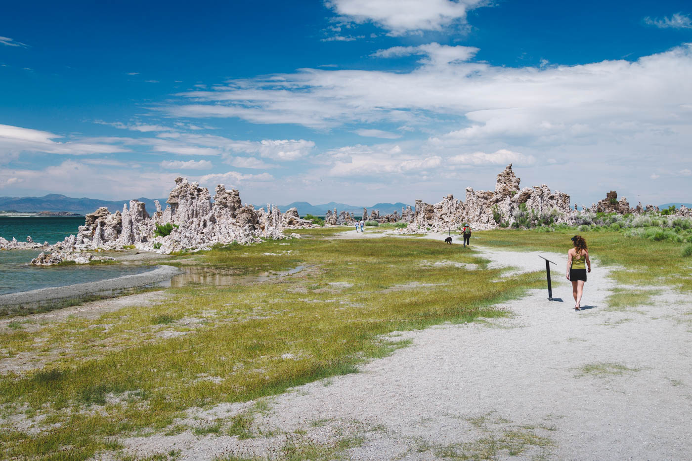
The main loop is an easy 0.8 miles with about 26 feet of elevation gain, or take the longer version at 1.3 miles if you want more shoreline time. South Tufa charges $3 per adult through a self-registration envelope at the trailhead — kids under 16 are free, and an America the Beautiful Pass covers it too, since this sits on Inyo National Forest land.
Panum Crater, if the tufa isn’t strange enough
A few miles south of South Tufa, Panum Crater is one of the youngest volcanic features in the Mono Basin — a rhyolite dome that formed only 600 to 700 years ago, geologically almost brand new. The rim trail runs about 1.6 miles with 324 feet of climbing, or take the shorter summit route at 1.1 miles for most of the view with less of the walk.
From the top, you get the whole picture at once: obsidian-streaked crater on one side, the entire lake and its tufa fields spread out on the other.
Before you go
Mono Lake sits right off Highway 395 outside Lee Vining, about 13 miles from Yosemite’s Tioga Pass entrance when the high road is open for the season — an easy add-on if you’re already routing through the park.
Wind picks up most afternoons here, so mornings are calmer for photos and for standing anywhere near the water. And that basin is at least 760,000 years old, which makes Mono Lake one of the oldest lakes in North America — worth sitting with for a second next time you’re on the shore.
Is it stranger that a lake this old nearly disappeared in 40 years, or that three decades later it’s still not all the way back? Either way, it’s still here — go see it!
Trip tips: grab a rental car for the drive out to Lee Vining, lock in a hotel in Mammoth Lakes or June Lake for the night, or skip both and book a camper van if you’re stringing this into a longer 395 road trip.
Rules and fees change — always confirm current requirements before you go.