This California mountain town invented the grading scale every rock climber in America uses
Every time a climber anywhere in the country calls a route a 5.9 or a 5.11, they’re using a scale that got its start on a single granite wall above a sleepy mountain town two hours from Los Angeles. Not Yosemite. Not the Sierra.
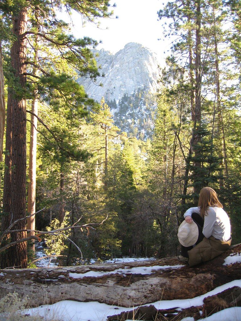
The wall is Tahquitz Rock, also called Lily Rock, and it’s been quietly shaping American climbing since the 1930s — long before anyone had heard of El Capitan, this is where the numbers got invented.
Psst — we made you a West Coast Adventure Map. Nearly 1,900 of our favorite spots, already pinned, ready to load into Google Maps in two clicks — grab it here.
How a mountain club turned a rock face into a rating system
Members of the Sierra Club’s Rock Climbing Section started exploring Tahquitz Rock in 1935, and a year later three of them made the first technical ascent of what’s now called The Trough. Some of the earliest climbs in the country ever rated 5.8, 5.9, 5.10, 5.11, and 5.12 were first put up on this exact wall.
In 1956, climbers Chuck Wilts and Don Wilson put together the first real guidebook to the area — and at the urging of a young Royal Robbins, they built in a numeric difficulty scale. That scale, refined over the decades, became the Yosemite Decimal System still used to rate every roped climb in the country today.
📍 GET THE ULTIMATE CALIFORNIA MAP 🗺️
Get our curated list of the best adventures and things to do north of LA loaded onto your maps with just two clicks!
✅ Waterfalls ✅ Hikes ✅ Viewpoints
✅ National Parks ✅ 1400+ Pins
Two trails, two very different days
The classic way up is Devils Slide Trail out of Humber Park — about 5.2 miles round trip to Saddle Junction, roughly 1,700 feet of climbing, rated hard. It’s also the access route serious climbers use to reach Tahquitz Rock itself, so expect to share switchbacks with people carrying ropes and chalk bags.
You’ll need a free wilderness permit for Devils Slide — grab one in advance or at the trailhead kiosk — and weekend slots get tight between Memorial Day and Labor Day. Parking at Humber Park also requires a National Forest Adventure Pass, or an America the Beautiful Pass works just as well, since this is San Bernardino National Forest land.
If you just want the view of Lily Rock without a wilderness permit and 1,700 feet of climbing, take the Ernie Maxwell Scenic Trail instead — same trailhead, about 5 miles round trip, closer to 850 feet of gain, no permit required. It’s the easier win, honestly, if a rope isn’t in your plans.
The town that grew up around it
Idyllwild sits at 5,413 feet in the San Jacinto Mountains, which is exactly why it exists — it’s been a warm-weather escape since 1890, when George and Sarah Hannahs opened a tent resort called Camp Idylwilde. A clerical error at the post office in 1901 changed the spelling to Idyllwild, and it stuck.
Cecil B. DeMille started filming Westerns in the surrounding valleys in 1914, and the town has leaned into its arts-and-outdoors identity ever since. Galleries and a summer arts academy sit a few blocks from gear shops selling chalk and cams.
Next time you hear a climber shout out a grade, you’ll know exactly which mountain town to thank.
Trip tips: grab a rental car to get out here, lock in your hotel before the good rooms are gone, or skip both and book a camper van instead.
Rules and fees change — always confirm current requirements before you go.