
This California waterfall reopened after 2 wildfires shut it down for years, and it’s still crawling with ladybugs every winter
Feather Falls disappeared behind a closure gate for years after the North Complex Fire tore through in 2020, and the Dixie Fire followed a year later. The trail just reopened, rebuilt bridges and all. Through two fires and a years-long closure, one thing never stopped happening: the ladybugs still show up every winter, right on schedule.
Psst — we made you a West Coast Adventure Map. Nearly 1,900 of our favorite spots, already pinned, ready to load into Google Maps in two clicks — grab it here.
Two fires, one long closure
The Feather Falls Trail sits inside Plumas National Forest, along a stretch of the Middle Fork Feather River corridor that the North Complex and Dixie fires burned through in back-to-back years. The trail sat behind a closure order for years while crews assessed the damage. In 2025, the Forest Service finished rebuilding the bridges, handrails, and observation decks the fires destroyed, and the trail reopened to hikers.
📍 GET THE ULTIMATE CALIFORNIA MAP 🗺️
Get our curated list of the best adventures and things to do north of LA loaded onto your maps with just two clicks!
✅ Waterfalls ✅ Hikes ✅ Viewpoints
✅ National Parks ✅ 1400+ Pins


What the hike looks like now
This isn’t the shaded forest walk it used to be. Nearly the entire canopy that once covered this trail burned, so you’re hiking past blackened trunks, young saplings, and wildflowers moving back in — under full sun for nearly the whole route.
The full loop runs close to 8 miles round trip (the upper leg is 4.5 miles one-way, the lower leg 3.5), plus a short half-mile spur out to the falls overlook, with roughly 1,800 feet of climbing along the way. AllTrails rates it moderate, but that rating was written before the shade disappeared — budget 4 to 6 hours, start early, and bring more water than you think you need.
Take the lower trail out and the upper trail back if you get to pick. The climb at the end is gentler that way, and your knees will thank you on the last mile.
The waterfall, and the number everyone gets wrong
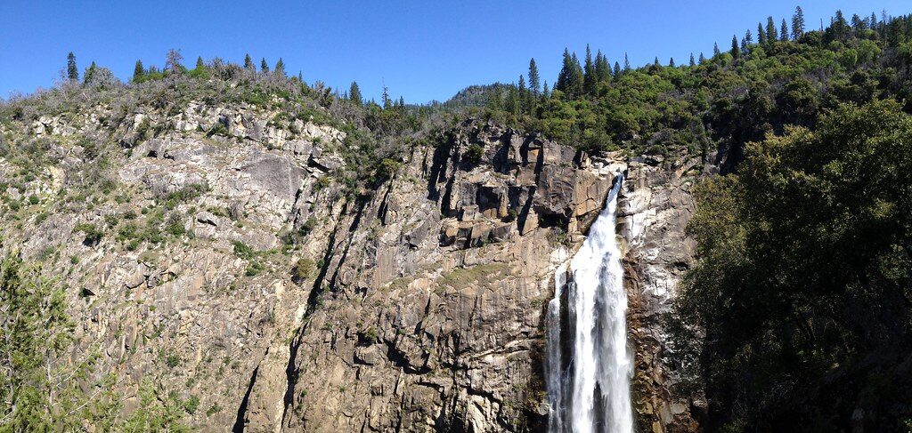
Feather Falls drops 410 feet down a granite face on the Fall River, and the Forest Service ranks it the sixth-highest waterfall in the country. You’ll still see it listed at 640 feet in older write-ups floating around online — that number has been debunked for years, but it keeps getting copied and pasted anyway.
The Middle Fork Feather River below it has carried a Wild and Scenic River designation since 1968, which is a big part of why this canyon never got developed in the first place.
The ladybugs no one mentions
Here’s the part that rarely makes the headline: millions of ladybugs migrate to Frey Creek, right along this trail, every winter between November and March. They ride out the cold season there before flying back down to the valley in spring. It has nothing to do with the fires or the closure — it’s just what Frey Creek does, every single year.
Before you go
The trailhead has a small campground with five sites if you want to stay over, and it sits roughly 25 miles from Oroville off Lumpkin Road. Rattlesnakes and poison oak are common along the trail, and the water above the falls moves faster than it looks — stay back from the edge and skip the urge to wade in for a photo.
Worth the years-long wait? Ask the ladybugs. They never left.
Trip tips: grab a rental car to get out here, lock in your hotel in Oroville or Chico before the good rooms are gone, or skip both and book a camper van instead — there’s a small campground right at the trailhead.
Rules and fees change — always confirm current requirements before you go.