10 WORTH IT Hikes in Lake Tahoe
With stunning blue waters and snow-capped peaks, it is no wonder there are some incredible hikes in Lake Tahoe!
Although it is easy to see the lake by car, one of the best ways to fully appreciate its beauty is to get out on foot and breathe in that fresh mountain air.
With short hikes, long hikes, flat paved trails, and steep climbs, there is a hike for everyone, no matter the time of year. Here are some of our favorite hikes in Lake Tahoe.
Note: Most trails below require a small fee for parking, usually $5, or display your state park pass.
Table of Contents
- 1. Eagle Lake Trail in Lake Tahoe With a Waterfall!
- 2. Emerald Point Trail
- 3. Rubicon Trail—Our Fav Trail in Lake Tahoe!
- 4. Balancing Rock Trail
- 5. Skunk Harbor Trail
- 6. Monkey Rock Trail
- 7. East Shore Trail—Scenic and Easy Trail in Lake Tahoe
- 8. Stateline Lookout Trail
- 9. Eagle Rock Trail
- 10. Cave Rock Trail
1. Eagle Lake Trail in Lake Tahoe With a Waterfall!
Distance: 1.8 miles
Type of Trail: Out & Back
Difficulty: Moderate
Elevation Gain: 429 feet
Other important info:
- Dogs are allowed
- There is a fee for this trail
The Eagle Lake Trail is very popular, and for good reason, so ensure you get to the parking lot early to nab a spot. A few other spots are sprinkled down the road if you don’t manage to get a space in the main lot—that’s where we ended up!

The trail starts with a bang, as not far from the trailhead, you’ll stumble across a waterfall cascading down into a river with a beautiful rocky viewpoint.
Make sure you get your rest, as from here on, you’ll be climbing rocky steps upwards, crossing the bridge over the falls before the climb continues. My glutes were burnin’ a bit here!

It won’t be long until you reach the stunning Eagle Lake, surrounded by snow-capped mountains and green pine trees. With such spectacular scenery, this one is hard to beat regarding the best hikes in Lake Tahoe. We chilled here for a while, taking it all in.
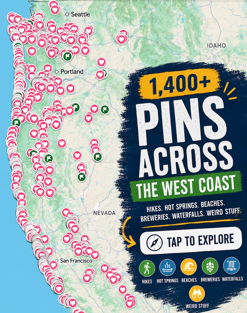
📍 GET THE ULTIMATE CALIFORNIA MAP 🗺️
Get our curated list of the best adventures and things to do north of LA loaded onto your maps with just two clicks!
✅ Waterfalls ✅ Hikes ✅ Viewpoints
✅ National Parks ✅ 1400+ Pins

2. Emerald Point Trail
Distance: 5.1 miles
Type of Trail: Out & Back
Difficulty: Moderate
Elevation Gain: 528 feet
Other important info:
- No dogs allowed
- There is a fee for this trail
If you are up for a slightly longer hike, consider Emerald Point Trail in Emerald Bay State Park. Start heading down towards Lake Tahoe to join the Rubicon Trail (more on this one below).
Follow the trail as it goes away from Vikingsholm Castle, along the shoreline cliffs, and up to a peninsula.

Along the way, enjoy the sights of the sparkling water glistening below you, towering mountains of tall red firs, and mixed pines.
The trail hugs the cliffs, contouring the stunning Emerald Bay, with views out over Fannette Island and very little elevation gain.

Every so often, you will pass steps down to the lake, the sparkling water beckoning you for a swim, and we wouldn’t blame you if temptation gets the better of you, especially on a hot day.
TIP: This is a very popular hike, so head out in the morning to avoid the crowds. You can also spend the day down here and tour Vikingsholm Castle or take a kayak out for a paddle.

3. Rubicon Trail—Our Fav Trail in Lake Tahoe!
Distance: 16.4 miles
Type of Trail: Out & Back
Difficulty: Hard
Elevation Gain: 2,339 feet
Other important info:
- No dogs allowed
- There is a fee for this trail
- Roads leading to the trailhead are subject to seasonal closure
The Rubicon Trail is one of the best hikes in Lake Tahoe. It traverses the terrain between Emerald Bay State Park and D.L. Bliss State Park, and you can rest assured that you will enjoy some of the most breathtaking views of Lake Tahoe.

You’ll find yourself on some incredible elevated vantage points, with the vast expanse of water stretching out before you.
This trail offers a bit of everything, including some flat sections, an old wooden lighthouse, cliffside walks, steep uphills, and slopes down to hidden coves and beaches. Campgrounds at either end of the trail make for the perfect day hike.

We stayed at Eagle Point, which was a perfect base to tackle this trail and explore all the things to do in Lake Tahoe!
TIP: Don’t be put off by its length. It is easy to do this in sections and just pick out the bits that work for you. We love this trail, but it is a long one, so don’t feel guilty breaking it up.
There is also a seasonal shuttle, which could be a great option. Check out our guide to the Rubicon Trail for more info.
4. Balancing Rock Trail
Distance: 0.7 miles
Type of Trail: Out & Back
Difficulty: Moderate
Elevation Gain: 177 feet
Other important info:
- No dogs allowed
- There is a fee for this trail
Follow this trail through the trees to reach the geological wonder that is Balancing Rock.
A huge boulder balances on a smaller rock that sticks out of the ground – spoiler, it is not balancing, it is attached to the rock below, but looks very precarious!

This nature trail is located in D.L. Bliss State Park and loops around the rock formation, offering views up close and from above. Along the way, you’ll also get some lovely Lake Tahoe views.
5. Skunk Harbor Trail
Distance: 3 miles
Type of Trail: Out & Back
Difficulty: Moderate
Elevation Gain: 580 feet
Other important info:
- Dogs are allowed
- No fees are required for this trail
The Skunk Harbor Trail takes you through winding forest paths to one of the lake’s hidden gems, Skunk Harbor Beach, which can only be accessed by hiking, biking, or boat. It truly is a magic hike from the get-go and one of the best hikes in Lake Tahoe.
As you traverse the path from the trailhead, keep an eye out for the old railroad grade in the path, which was once used for carrying timber.

As you hike through the forest, breathe in the scent of pine and look for those distinctive hints of sparkling blue that mean you are getting closer to the lake shore.
Spend some time sunbathing and swimming in relative peace in the tranquil little cove before mustering up the energy for a climb back up the hill to the trailhead.
🏨 Need a place to crash nearby?
From rustic cabins to boutique inns—check prices and availability in just a click.
6. Monkey Rock Trail
Distance: 2.6 miles
Type of Trail: Out & Back
Difficulty: Moderate
Elevation Gain: 498 feet
Other important info:
- Dogs are allowed
- There is a fee for this trail
At just over a mile each way, Monkey Rock Trail offers expansive views of the lake and one of the best sunsets over the northern Sierras. Unsurprisingly, it’s also a pretty popular hike in Lake Tahoe.
From the parking area, head up the path behind Tunnel Creek Cafe along a mostly flat path. Just after half a mile, you will start on the Monkey Rock Trail and climb up to the viewpoint.

Although you are going uphill most of the way past this point, the incline is relatively mild.
Once you reach the peak, you’ll be able to admire the namesake rock, which looks remarkably like a monkey. The panoramic views of the lake and coves are out of this world.
7. East Shore Trail—Scenic and Easy Trail in Lake Tahoe
Distance: 5.2 miles
Type of Trail: Out & Back
Difficulty: Easy
Elevation Gain: 344 feet
Other important info:
- Dogs are allowed
- No fee is required for this trail – depending where you park
- This is an accessible trail
Although the aim is for this epic trail to eventually go all around Lake Tahoe, at the moment, this paved trail covers nearly three beautiful miles, helping explorers and nature seekers navigate the steep terrain of the shores.

The trail runs just below the road, so you are about as close to the water as you can be, and the numerous interpretive panels along the route help tell you exactly what you are looking at.
The great thing about this trail is that it is 10 feet wide, meaning it’s accessible to all. We enjoyed the walk all the way from Incline Village to Sand Harbor State Park. It’s also a perfect path for bikers and it is open all year round.

TIP: You can’t park in many places, as the signs around the parking areas say you can park for 20 minutes only, and you don’t want to be fined. We parked at Sand Harbor, which charges for parking, but it’s more convenient.
8. Stateline Lookout Trail
Distance: 1.7 miles
Type of Trail: Loop
Difficulty: Easy
Elevation Gain: 305 feet
Other important info:
- Dogs are allowed
- No fee is required for this trail
This paved trail may be short, but it is steep, so get ready for a climb. We are talking about a grade of 8% to 12%. It was a mini calf workout for us—it’s a good prepper for the rest of the trails in Tahoe!

Despite its short length, you start in Nevada and end up in California! From the moment you step foot on the trail, the lake’s views keep improving as you wind your way up around the hill, straddling the state line.
Once you reach the top of the hill, there is a great viewing area with a few interesting interpretive signs, benches to catch your breath, and stunning views out over the lake.

This area used to be the home of a fire lookout tower—in fact, one of the earliest fire lookouts in the Lake Tahoe Basin. Although it was taken down in 2002, you can still explore the base of the tower.
9. Eagle Rock Trail
Distance: 0.7 miles
Type of Trail: Out & Back
Difficulty: Moderate
Elevation Gain: 236 feet
Other important info:
- Dogs are allowed
- No fee is required for this trail
You don’t need to climb a mountain to get incredible vistas of the lake; Eagle Rock Trail has you covered and is one of the best hikes in Lake Tahoe.

Short and sweet, the Eagle Rock Trail packs a lot of punch. The trail starts as a path with some nice clear switchbacks, but it isn’t long until the path turns to rocks and you’ll have to use your trail-finding skills to find the path.
Essentially, if you keep heading upwards, you can’t go too wrong, and once you reach the rocks at the top, the views of Lake Tahoe and the surrounding forests are breathtaking.
TIP: If you can make it up for sunrise, you won’t be disappointed.

10. Cave Rock Trail
Distance: 0.8 miles
Type of Trail: Out & Back
Difficulty: Easy
Elevation Gain: 118 feet
Other important info:
- Dogs are allowed
- No fee is required for this trail
Head up to the top of Cave Rock and then hop back in your car and drive through the tunnel along Highway 50.
It’s a short hike with big rewards. For most of the route, you’ll have views of the lake, and before long, you will reach the base of the rock. At this point, it is up to you if you go up.
If you are up for a bit of a scramble, go for it! You may need to use your hands, but it isn’t too tricky.

Cave Rock, also known as Lady of the Lake, can be seen from most points around the lake and is considered sacred to Washoe Indians. Look very carefully, and you may see a woman’s face in the rocks.
TIP: There isn’t much parking, but the hike only takes around 15 minutes, so it is a very short turnover. It is perfect if you are short on time but still want some epic vistas, and it is even better at sunset.
Read more of our guides to Lake Tahoe:
- 18 BEST Things to Do in Lake Tahoe in Summer
- 12 BEST Views of Lake Tahoe
- Rubicon Trail—Lake Tahoe’s Most Worth It Hike!
- Secret Cove Beach in Lake Tahoe (Plus 4 Others!)
- 10 WORTH IT Hikes in Lake Tahoe
- 13 BEST Beaches in Lake Tahoe
- Sand Harbor Beach at Lake Tahoe
- Sugar Pine Point State in Lake Tahoe
- Emerald Bay State Park in Lake Tahoe
We hope this helped you figure out which hikes in Lake Tahoe to tackle!