Point Lobos Hike: One of The Best Hikes on The California Coast!
You won’t have to look elsewhere to get your Californian coastal fix than Point Lobos State Natural Reserve, also known as the ‘Crown Jewel of the California State Parks System.’ Located very close to Carmel-by-the-Sea and Monterey, the park is easily accessible and VERY popular!
The park has a little bit of everything.
✅Coastal views? Check.
✅Walks through the forest? Check.
✅Beaches? Check.
✅Local wildlife? Check!

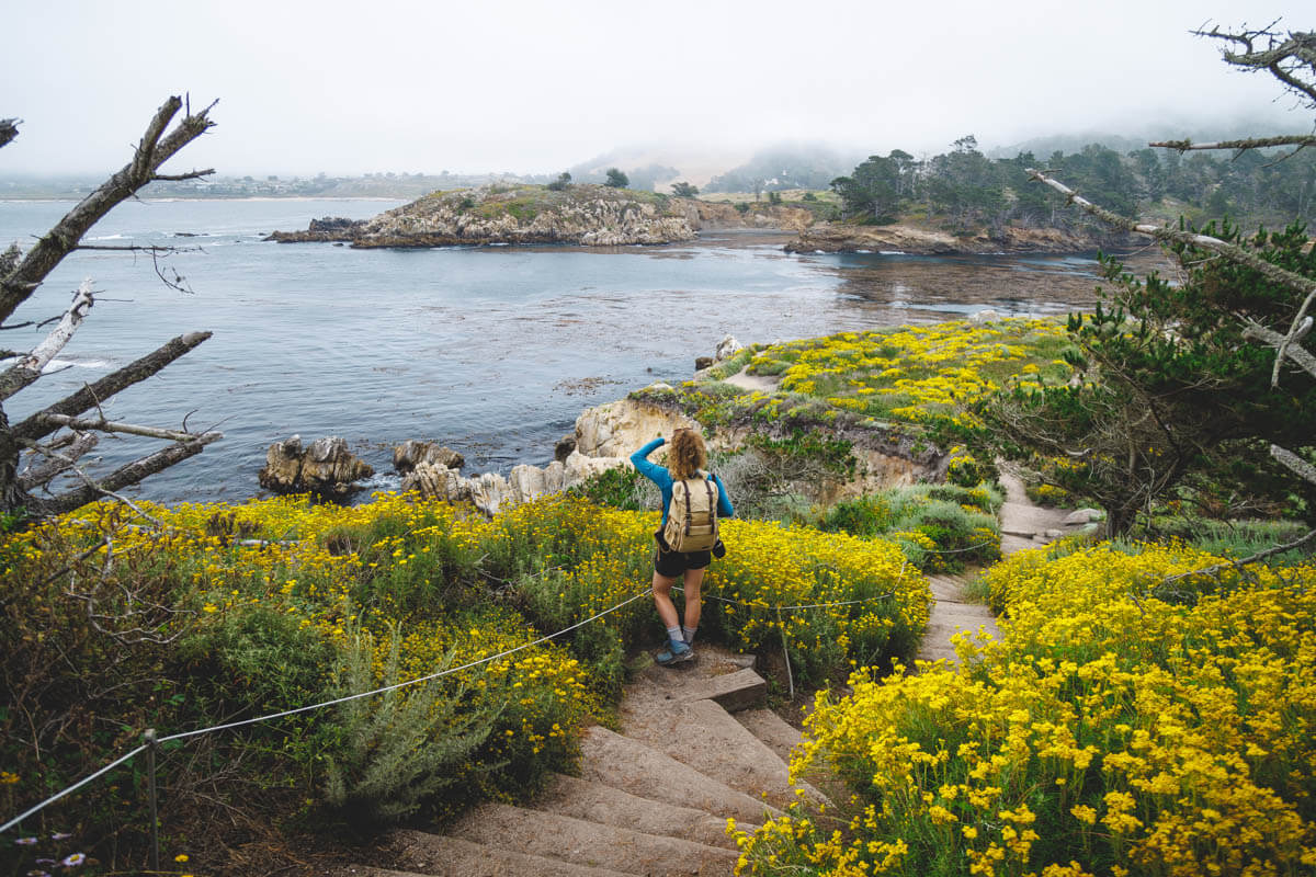
The hike hugs the coast of this epic peninsula, taking you to hidden coves, beach lookouts, islands filled with bird life, and forests of Monterey pine. There is a perfect chance you will spot seals, sea lions, and maybe even whales as you walk.
In fact, there are over 300 plant species and around 250 animal species found in the reserve alone!
Take in the highlights of the reserve on this incredible Point Lobos hike, and after seeing it once, there is a good chance you will want to come back for more (says me, someone who’s hiked this trail twice now!)
Hiking in Point Lobos—Everything You Need to Know!
We’re going to talk about the hike in Point Lobos in sections, but really, it’s one big loop hike with a couple of side quests that loop you away for a brief moment and then plop you back on the trail.
We have to say, this is truly one of the best hikes in Monterey and maybe even one of the top hikes in California overall! You just truly get so much, and each corner is a different type of beautiful.
Before we get into this hike in Point Lobos, though, trust us, you’ll need some of our advice before getting here…
How to Get to Point Lobos
Although in Point Lobos, it may feel like you are in the middle of nowhere, you may be surprised to find out that it is only 10 minutes from the beautiful town of Carmel-by-the-Sea.

If you are coming from the south, you only need to travel directly north up Highway 1. If you are coming from the north, you must head south down Highway 1. From Monterey, it is only about a 15-20 minute drive. The reserve is directly off of the highway.
Parking in Point Lobos
Let’s touch on the parking situation, because we will be honest, it is a nightmare. So you want to visit with the knowledge of what to expect when you arrive.
There are several parking lots within the park, the problem is there are nowhere near enough spaces for the number of visitors. They can fit about 150 cars, which is tiny compared to how many groups visit the park in one day.

When the lots are full, and they fill up quickly, there is a sign placed by the park entrance saying the lots are full, and that sign remains there for the majority of the day. So get there VERY early if you have your heart set on parking within the park.
If you are not early enough to get a spot within the parking lots, you have to join the many other vehicles that park up along the shoulders of Highway 1. As mentioned, lots of cars usually have to do this, so you could be parking a long way from the entrance to the park, meaning additional walking time before you have even started the Point Lobos hike.

On top of that, you’ll have to take the uncomfortable walk down a crappy road shoulder/maybe on the road too. I ended up having to do this my first time visiting, but I knew better on my second visit!
To make matters worse, you can get a ticket if you park in certain areas on the side of the road, so be sure to pay attention to signage… or, you know, just get here early!
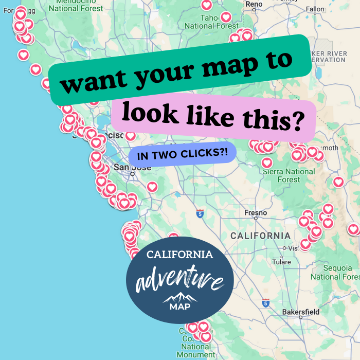
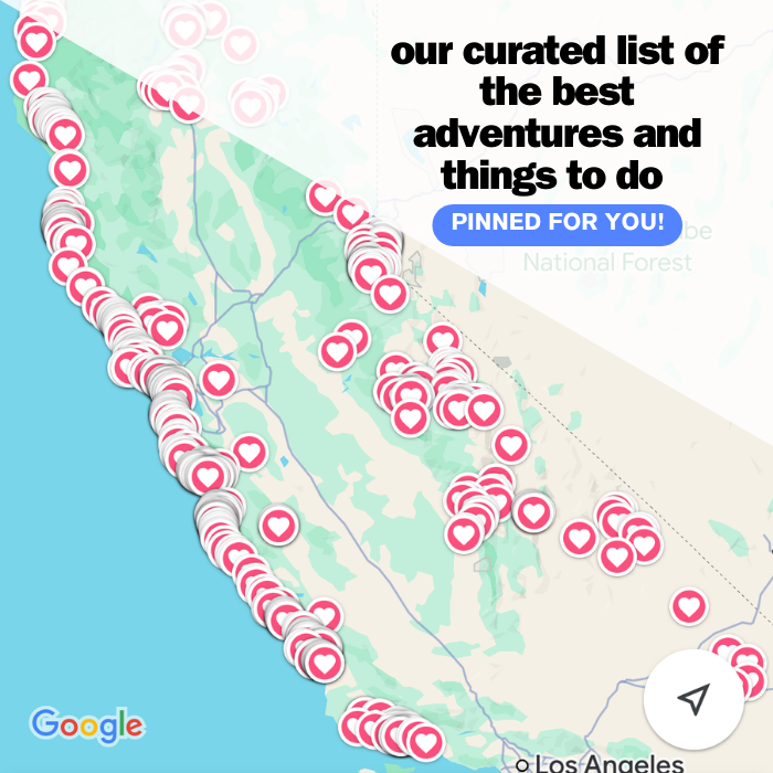
📍 GET THE ULTIMATE CALIFORNIA MAP 🗺️
Get our curated list of the best adventures and things to do north of LA loaded onto your maps with just two clicks!
✅ Waterfalls ✅ Hikes ✅ Viewpoints
✅ National Parks ✅ 1400+ Pins
The Point Lobos Hike Loop
Length: 6.4 miles
Type of hike: Loop
Difficulty: Moderate
Elevation gain: 679 feet
The Point Lobos Loop Trail combines some of the best trails in the park to create one epic Point Lobos hike that takes in the park’s many incredible natural highlights.
If you have the time, we strongly recommend that you tackle the whole thing in one go, and as it is a loop, it will bring you back nearly to where you parked your car (see parking drama above in case you skipped it!).

Seeing as it is a loop, you can hike the trail in either direction, but for this case, we will hike in an anticlockwise direction and start at the Point Lobos State Natural Reserve entrance.
Although it can also be started from pretty much wherever you manage to park your car. Due to the nature of the hike, it is possible to add bits on, take side trips down to the beaches, or miss out on sections that you don’t have time for.

From the trailhead, start walking along the Carmelo Meadow Trail until you get to your first vista of Whalers Cove, and then the real fun begins.
Carmelo Meadow Trail
The Carmelo Meadow Trail starts from the park entrance and will take you to Whaler’s Cove.
It’s only a short trail and very flat and accessible, but it is nice and shaded, taking you through a lovely walkway of Monterey pine. The trees grow in size and space the further along the trail you go until you get your first glimpse of the sea.

Although named the Carmelo Meadow Trail, the actual meadow is now the other side of the trees due to path rerouting, but you should still be able to see it and the brightly colored flowers it boasts if you take the Granite Point Trail.
🏨 Need a place to crash nearby?
From rustic cabins to boutique inns—check prices and availability in just a click.
Granite Point Trail
Starting near the Whalers Cabin, you will find the trailhead for the Granite Point Trail. Essentially, the hike takes you to Granite Point and back again via a few scenic lookout points, winding through meadows and woodlands.
It is a bit of a detour from the main route, almost an out-and-back spur, but the views make the additional mileage worth it on this Point Lobos hike!

The trail starts following the bluff that skirts the scenic cove below, which is full of brightly colored wildflowers in the spring and summer.
If you prefer, you can add a few steps by taking the short loop at Coal Chute Point Lookout or continue on the trail until you reach Granite Point Lookout, which will take you through beautiful forests of fragrant pine. The lookout offers great views out to Granite Point, where you are about to go!
Descend the steps and either take the short detour through a ravine to an area known as The Pit, more on that later, or continue on the trail and on to Granite Point. The trail takes a strategically scenic loop around the point, where the views are out of this world.

Look one way, and you can take in Moss Cove, and further afield, you should be able to see Carmel Bay and Pebble Beach, while in the other direction, Whalers Cove beckons you back to the hike’s starting point.
Keep an eye out for marine life out to sea, as sightings of dolphins or even whales are not uncommon here.
Whalers Cabin Museum and Snorkeling
Once you have finished the Granite Point loop and come back to the crossroads where you came off of the Carmelo Meadow Trail, it is time to enjoy the beauty of Whalers Cove and delve into history at the Whalers Cabin Museum!

Find out more about the whaling history of Point Lobos State Natural Reserve at the museum. We spent at least an extra 15 minutes here just wandering and learning about the history here.
The cabin was built in the 1850s and is a great place to learn about the complicated past that humans have with the area. The cabin was in use until 1983 before turning into the small museum that it is today.
The seas around Whalers Cabin and the nearby Bluefish Cove are the perfect places to learn more about life under the water by actually heading under the water!

In these two spots, and these two spots only, you can snorkel or scuba dive, although you will want to get in there quickly if you want to secure a spot. It is a popular place to dive, with only limited diving spots available.
The area has one of the richest marine habitats in California, so you can almost guarantee a great dive full of life!
North Shore Trail
The North Shore Trail connects Whalers Cabin and the Cabin Trail to the parking lot for Cypress Grove, yet in an incredible stand-alone hike as well. You traverse the way through pine forests, with views out over the coves and rocks below.

There are surprises at every turn, with the dramatic high cliffed coves below carved into shape from the relentless pounding, powerful waves. Bluefish Cove is just one of these dramatic coves, and if you look carefully, you may be able to spot the seals or otters that inhabit the coves.
Cannery Point is another must-stop viewpoint when it comes to views. You can see right out across Whalers Cove, Guillemot Island, and Carmel Bay.
There are some steep stairs along the path, which is how you can get such incredible views, making it a tricky trail to traverse.

Try and make the time to take the short side trail that takes you to the best viewpoint of the famous Old Veteran Cypress. Twisted and rugged after the relentless battering of winds and weather, it stands proud and strong on the cliff edge, so don’t forget your camera.
*Other Option: Whaler’s Knoll
Rather than the North Shore Trail, the Whale’s Knoll Trail is an alternative way to reach the Cypress Grove Trail. If you want to take the Whaler’s Knoll Trail inland, it gives you the chance to climb through the pine forest and up to the top of Whaler’s Knoll, a panoramic spot that was used as a lookout for whales when whaling was still in operation in the area.
Cypress Grove Trail — One of The Best Areas to Hike in Point Lobos
The Cypress Grove Trail is one of the true gems of Point Lobos State Natural Reserve and is a slight looped diversion from the main trail—It’s one of our favorites!
Atop a huge cliff, you will walk through a dense grove of Cypress trees with incredible coastal views. At only a one-mile round trip, this is a must-do add-on to the main Point Lobos Trail and one of the most popular hikes in the park.

The trees you’ll be walking under are Monterey Cypress, and this is only one of two places where they are natively found. They just love the fog that shrouds this area in the mornings.
You can take the small loop in either direction, following the clearly marked dirt path under the shade of the twisted, algae-covered branches. Once you have made it through the trees, the path opens up to incredible coastal views.

Many of the trees are covered in white and red moss, which is not something you see every day. These sets of stairs along the route give you an even better vantage point of the coastal cliffs and groves.
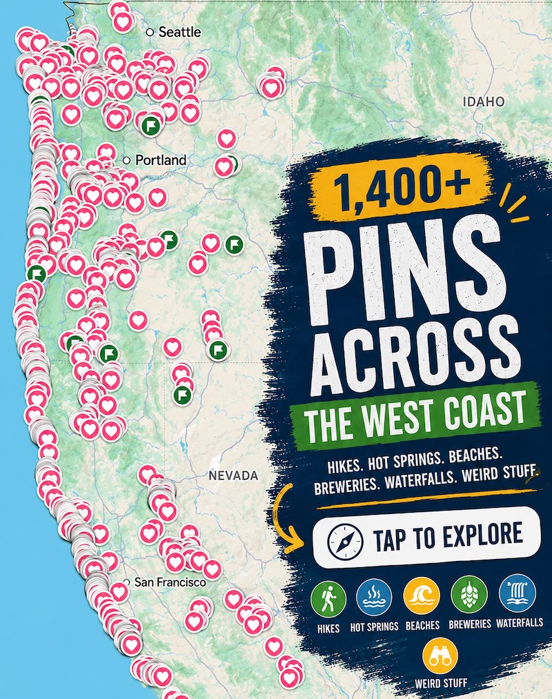
🕒 Save hours of planning time! ⛰️
📍 Get The Ultimate West Coast Map
1400+ breweries, trails, waterfalls, beaches, and weird roadside stops—mapped for you!
Sea Lion Point Trail
We love Sea Lion Point Trail; it’s a must-walk on your Point Lobos hike! But it is no surprise it’s one of the most popular hikes in the park. (OK crap, that’s like every part of the hike pretty much… told you you need to do the whole thing!)
As the name suggests, you should expect to find a few sea lions along the route, and chances are you will hear them long before you see them. These sea lions like to huddle on the rocks just offshore, and sea lions in numbers mean a lot of loud barking.

This short Point Lobos hike passes several beautiful coves, including Headland Cove, Sea Lion Cove, and Sand Hill Cove, each is postcard perfect, with incredible views of the rocky coastline and offshore rocks.
In addition to the sea lions, you have a good chance of spotting harbor seals in this area, as well as playful otters if you are really lucky, but don’t get your hopes up; these slippery creatures are notoriously shy.
Be sure to keep a lookout for the Devil’s Cauldron, a rock formation known for its very powerful and dangerous churn. You will find it just below the Sea Lion Point viewpoint, so don’t get too close to the edge!

This short loop is only 0.6 miles long, and due to the abundance of wildlife, sea views, and wildflowers, it is definitely one to add to your route. Wild and well-maintained, with minimal elevation gain, it should be suitable for most visitors.
South Shore Trail
The South Shore Trail is one of the longer stretches of trail, as it goes on for 2 miles and showcases some of the highlights of the southern side of Point Lobos State Natural Reserve.
South Shore Trail essentially connects Bird Island Trail with Sea Lion Point Trail but has a lot to offer as a stand-alone trail. The sea views are expansive, with high cliffs of rock pummeled by the crashing waves below. Because of the expansive views, it is an excellent spot for birding and whale watching.

One of the highlights along this stretch of the trail is Weston Beach, a tide-pooling heaven. The many pools are filled with colorful creatures like crabs and sea stars, which can be viewed at low tide.
Bird Island Trail — Top Area to Hike in Point Lobos
For many people, the Bird Island Trail is the best part of the Point Lobos hike. It is only 0.8 miles and takes you past some seriously stunning spots.
The path will take you past China Cove, arguably the most beautiful cove in the reserve, with stunning green/blue waters, and the chance to see harbor seal pups in the spring.
Next along the route is Gibson Beach, which has picnic tables and easy access down onto the sand, making it a popular lunch stop.

After that, you have Pelican Point and Bird Island Overlook, where the trail got its name.
The small, rocky island sits off the shore and is a riot of sea birds! The noisy bits clamor for a space on the rocks. Although the rock is only a little off the shore, bring binoculars to help you identify the Brandt’s cormorants, Western gulls, and black-crowned night heron.
One thing to note about the Bird Island area is that it can be a bit stinky! There are A LOT of birds, and you’re not too far from their home, where all the business gets done. Mix in the coastal breeze, and yeah, the stench is unavoidable.

TIP: If you’re low on time and can’t do the whole Point Lobos loop, the Bird Island section is perfect! It’s not too far from the entrance, so just go left when you enter the park, hike this area, and then leave, and you will have seen a well-worth-it bit!
It’s about 2 miles round trip from the entrance to Bird Island and back.
South Plateau Trail
Trek through pine and oak woodland on your way back to the park entrance from the Bird Island Trail. At 0.7 miles, it may not be the longest trail, but it is bumpy and hilly, so wearing good footwear is a must.

You’ll get a bit of car noise from the highway here, bringing you sharply back to civilization after a day out in nature. In spring, the ground may be covered in wildflowers, with abundant honeysuckle, coffeeberry, and Douglas Iris. All too soon, you’ll be back at the entrance, planning your next Point Lobos hike!
Additional Trails in Point Lobos
While the trail above gives you the best overview of the entire park, if you don’t have time, you can use the following “cut thru” hikes which shaves off some time if you’re pressed for it. The following trails in Point Lobos head through pine forests in the middle of the park, which is inland.
- Mound Meadow Trail – The Mound Meadow is a quiet trail that takes you almost from the park entrance and down to the south shore of Point Lobos. Once you do reach the ocean, you will find yourself at Mound Meadow near Weston Beach. (Do Bird Island area in a jiff!)
- Lace Lichen Trail – The 0.5-mile Lace Lichen Trail is known for the abundance of lace lichen, otherwise known as old man’s beard, that covers the trees in this section of the park, capturing all that moist goodness from the moss. (Cut straight up the middle to get to Sea Lion Point and Cypress Grove)
Beaches Along The Point Lobos Trails
Point Lobos State Natural Reserve is not all about the trails, the peninsula also boasts some spectacular beaches with easy access from the trails.
Whether you choose to spend the whole day on the beaches or just stop to admire the waves for a while before you continue your Point Lobos hike, there are a lot of options. But keep in mind, these aren’t your sunbathing type of beaches! Just in case you were wondering.
Weston Beach
Weston Beach is not the best beachy beach, but it has some incredible tide pools if you time it right with the tides, although be very careful of the sneaker waves that regularly frequent the area.

The Pit
The Pit is a cool beach because the waters here are usually pretty calm, and there is a good chance of spotting wildlife such as seals, cormorants, and great blue herons.
Gibson Beach
Gibson sits to the far south of Point Lobos and is often described as one of the best beaches in the park. It’s definitely the “beachest” of the beaches in Point Lobos.
It actually has real-life sand and is a great place to sit and chill and take everything in. To reach the beach, you will have to take the Bird Island Trail.

Hidden Beach
Hidden Beach may not be the most picturesque of beaches with its gray pebbles rather than sand, yet it is relatively popular due to how easy it is to access. It can be found along the South Shore Trail, down some steps right off the trail.
China Cove Beach
China Cove is a stunning little cove, rich with emerald waters, and a teeny, tiny sand beach, with cool rock formations at low tide. Oh, right, and tons of sea lions! You can only admire this spot from above.

Best Time to Hike Point Lobos State Natural Reserve
Point Lobos is the type of park that is beautiful to visit, no matter the time of year. If you want to see the wildflowers in full bloom, then spring is a great time to visit the park, although you should still expect some chilly days and a fair few days of rain.

As spring turns to summer, the park starts to fill up with visitors, and the weather gets a little warmer. Bear in mind that in summer, thick coastal fog is common in the morning, so maybe plan your visit for the afternoon if possible, so you give the fog a chance to burn off. (But then again, the parking situation could bite you in the butt too)
Come fall, the weather will start to get a little colder again, but the days will mostly be clear, so if you wrap up warm, it can be a lovely time to visit the park, plus the crowds will have thinned a little.

Winter is when the trails will be much quieter, although if you are lucky enough to visit on a clear day, the sunsets are truly out of this world.
Quick Questions About The Point Lobos Hike:
The whole thing will be between 6-7 miles, but you can make the hike shorter by doing certain sections, which we break down for you below.
There’s no bad trail here! But if you can do the full Point Lobos Loop Trail, you’ll get to see everything for a relatively easy effort.
The full trail overall is pretty easy, just a bit long. You could choose a small section of it and just wander around. Cypress Grove or Bird Island areas would be good choices.
You could spend a quick hour here or most of the day! The full loop trail will take around 2.5-3 hours or more if you stop a lot (or park far).
You can get in with your CA Explorer Annual Pass, pay $10 per vehicle to enter, or park for free outside on the side of the highway and walk in.
Tips for Visiting Point Lobos
- Some of the trails are quite narrow, and if they have two-way traffic, this is something to keep in mind. If you don’t want to squeeze past crowds of people as you hike, you might be better off visiting during the shoulder season.
- The majority of the way, the trail is flat and easy, but you are still in nature, so you should look out for rocks and tree roots that seem determined to trip you up. It’s best if you wear sturdy shoes with a good grip. This isn’t a beach walk! There are also stone steps in some areas.
- It’s not just the spring when the wildflowers are in bloom. We visited at the beginning of July, and the flowers were still beautiful!

- Carry plenty of water, if you plan on seeing a lot of the park, it will require lots of walking, so you want to ensure you have enough to last and that you will stay hydrated. Similarly, there are no places to buy food and drinks in the park, so you want to make sure you bring whatever you are going to need for the day.
- Like with most popular hikes, the earlier you can get there, the better chance you will have for a quieter hike. This should also help with the parking situation, which, as we mentioned, can be a nightmare. If you can be at the park at opening time, that is probably for the best.
- Bring binoculars with you if you have the space, as the park is full of wildlife. Tons of birds and mammals call the park their home, on land and in the ocean, and the binoculars will give you a much clearer view of whatever you manage to spot.

- Once you park, don’t move your car and just use the trails to get around the whole way. If you move your car in the middle of the day, your chances of finding another spot are very limited, and you will just add more stress to the trip.
- Always stay on the marked trails. It may be tempting to wander off and take a look at an interesting wildflower or see if you can get closer to some sea creature, but you’ll protect the habitat if you stay on the paths, and there is less chance of running into some poison oak.
- Your parking fee is valid for the entire day, so you are allowed to leave the park and then come back again, however, there is a very good chance you won’t be finding a spot when you return.
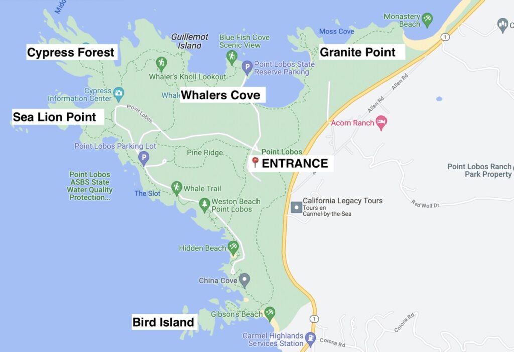
Map of Point Lobos
Here’s a handy map to better show you the sections we went over above for your Point Lobos hike!
We hope this helped you plan your visit and hike in Point Lobos!