
San Francisco once had a glass palace for 10,000 swimmers, and the Pacific still washes through what’s left
San Francisco used to have a swimming complex so big it could hold 10,000 people at once, under a giant glass roof, fed by the Pacific itself. It burned in 1966. What’s left is a field of concrete walls and flooded pools at the very edge of the city, and it’s one of the most photogenic places in the whole Bay Area.
Plenty of people see Sutro Baths from the parking lot, snap a photo, and leave. Don’t do that. Walk down into the ruins, then keep going along the cliffs, because the best part of this corner of San Francisco is everything past it.
Psst, we made you a West Coast Adventure Map. Nearly 1,900 of our favorite spots, already pinned, ready to load into Google Maps in two clicks. Grab it here.
What Sutro Baths actually was
Adolph Sutro was a self-made millionaire and, at one point, mayor of San Francisco. In the 1890s he built a public bathhouse at Lands End that covered three acres, with seven pools kept at different temperatures, slides, trapezes, springboards, and a high dive.
The whole thing opened in 1896, and the ocean did the heavy lifting. At high tide, the Pacific could fill all 1.7 million gallons of pool water in about an hour. The baths also rented out 20,000 bathing suits and 40,000 towels, which is a very specific flex.
It wasn’t only a pool, either. There were museum exhibits, concerts, talent shows, and restaurants, plus a railroad that made it an easy family day trip from the rest of the city.
It also played a part in California civil rights history. In 1897, a San Francisco man named John Harris was turned away from the pools because he was Black, sued under the state’s brand-new Dibble Civil Rights Act, and won.
📍 GET THE ULTIMATE CALIFORNIA MAP 🗺️
Get our curated list of the best adventures and things to do north of LA loaded onto your maps with just two clicks!
✅ Waterfalls ✅ Hikes ✅ Viewpoints
✅ National Parks ✅ 1400+ Pins


Why it’s ruins now
The baths never made much money over the long haul. The Great Depression, fewer transit options, and new public health codes all hurt, and a conversion into an ice-skating rink didn’t save it.
By 1964, developers had plans for high-rise apartments on the site. Then in 1966, a fire tore through the building while it was being demolished, leaving only the concrete foundation. Since 1973, the ruins have been part of Golden Gate National Recreation Area.
Here’s the thing: the ruins might be more fun to visit than the original. You get crumbling walls, still water reflecting the sky, cypress-covered cliffs above, and waves hammering the rocks just past the old pool edges. On a foggy morning it looks like a movie set nobody bothered to strike.
Keep walking: the Lands End Trail
The ruins sit at the start of the Lands End Trail, one of the best walks in the city. The full loop runs 3.4 miles with about 550 feet of climbing and is rated moderate, so you’ll hit some stairs, but nothing that ruins your afternoon.
We’ve done this one, and the payoff keeps coming. You duck through dark stands of cypress, pop out onto open bluffs, and suddenly the Golden Gate Bridge is sitting right there at a completely different angle than the postcard shot.

A few stops worth slowing down for along the way:
- USS San Francisco Memorial: honors a WWII cruiser that took 45 hits and 25 fires during the Battle of Guadalcanal in 1942.
- The shipwrecks: from viewpoints along the trail you can spot remains of three wrecks, the Ohioan (1937), Lyman Stewart (1922), and Frank Buck (1937). Low tide gives you the best shot at seeing them.
- Mile Rock Beach: a short spur trail drops down to a rocky pocket beach with a view straight across the Golden Gate. Want more like it? Here are our favorite Golden Gate beaches.
- The stone labyrinth at Eagle’s Point: a hand-laid rock labyrinth perched over the ocean. It’s been wrecked and rebuilt more than once over the years, so consider it a bonus if it’s there when you are.
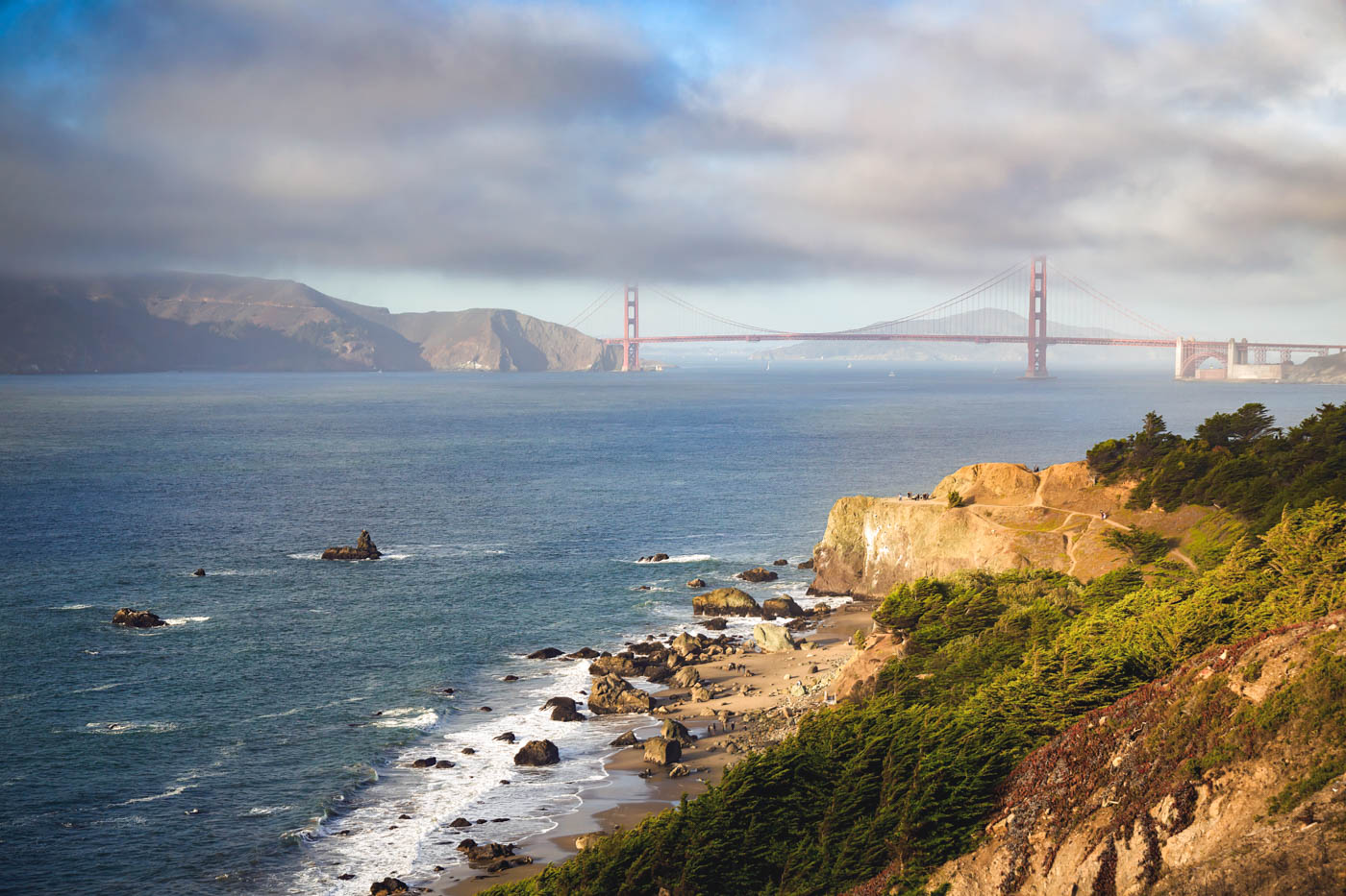
Short on time? The Sutro Trail portion around the ruins is 1.5 miles round trip and rated easiest by the Golden Gate National Parks Conservancy. That’s plenty to get the ruins, the cliffs, and a peek at the bridge.
The best time to go is right now
Everyone visits San Francisco in summer and then complains about the fog. September is typically the city’s warmest month, and October isn’t far behind, which makes fall the sweet spot for clear views from Lands End.
Sunset is the move if you can swing it. The ruins face west, so the light drops right over the old pools. Just remember this is a wild, windy stretch of coast, and the NPS asks hikers to stay on trails and keep their distance from the cliffs.
Getting there
Start at the Lands End Lookout visitor center at 680 Point Lobos Avenue, where you can get oriented and learn more about the area’s history. The wheelchair-accessible trails begin at the Merrie Way parking lot, and there’s more parking at the end of El Camino del Mar.
The Parks Conservancy calls public transportation the best way to get to Lands End. Want more of this side of the city? Our guide to Golden Gate National Recreation Area covers the rest, and our roundup of Golden Gate Bridge viewpoints will keep your camera busy.
Trip tips: grab a rental car if you’re turning this into a bigger Bay Area trip, and lock in your hotel before the good rooms are gone.
So, would you have braved an 1896 high dive over ocean-fed water, or are you strictly a ruins-and-sunset person? Tell us in the comments.