
California’s own elk nearly vanished in the 1870s, and right now their bulls are bugling across this Marin County bluff
Somewhere around 1870, California’s own elk came terrifyingly close to disappearing for good. DNA evidence suggests the entire subspecies may have squeaked through with as few as a single breeding pair, hiding in the marshes near Bakersfield.
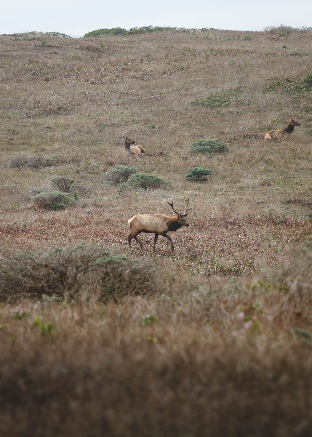
Now picture this instead: a foggy ridge above the Pacific, a bull elk with a rack like a coat stand, throwing his head back and letting out a high, eerie whistle that carries across the whole bluff. That’s Tomales Point in Point Reyes National Seashore right now, and the show only runs a few months a year.
Psst, we made you a West Coast Adventure Map. Nearly 1,900 of our favorite spots, already pinned, ready to load into Google Maps in two clicks. Grab it here.
The elk that only live in California
Tule elk are the smallest elk in North America, and they don’t exist anywhere else on Earth. Early explorers’ accounts suggest around 500,000 of them once grazed from the Sierra foothills to the coast.
Then came the hide hunters, the Gold Rush, and market hunting. By 1870, only a few were left near Buena Vista Lake in Kern County, where a cattle rancher named Henry Miller decided to protect them on his land.
That one decision is basically why you can see them today. California’s Department of Fish and Wildlife now puts the statewide count at roughly 5,700 tule elk, spread across dozens of herds.
📍 GET THE ULTIMATE CALIFORNIA MAP 🗺️
Get our curated list of the best adventures and things to do north of LA loaded onto your maps with just two clicks!
✅ Waterfalls ✅ Hikes ✅ Viewpoints
✅ National Parks ✅ 1400+ Pins


Ten elk, one peninsula, and a herd of 300-plus
Tule elk vanished from the Point Reyes peninsula back in the 1850s. In 1978, wildlife agencies trucked in ten of them (eight cows and two bulls) from a refuge near Los Banos and released them on Tomales Point.
The Park Service’s 2024 census counted at least 315 elk in the Tomales Point herd alone, with more than 700 across the park’s three herds. For almost half a century, the Tomales Point animals lived behind a long fence across the peninsula, but the Park Service took it down in late 2024, and the herd now roams free.
Why late September and October are the sweet spot
Tule elk rut from August through October, which is a polite way of saying the bulls spend three months bugling, posturing, and occasionally locking antlers over groups of cows. The bugle itself sounds nothing like you’d expect from an animal that size. It’s a squealing, rising whistle, and once you hear it echo off the hills, you won’t forget it.
Timing gets even better this late in the season. The Park Service notes that August and September often bring dense fog to the coast, while late September through early November usually delivers some of the clearest days of the year out here.
Rut season also means the bulls are running on pure hormones, so give them real space. Rangers ask visitors never to get between two bulls or between a bull and his cows, and to back off if an elk gets alert or starts moving away. Their elk viewing page has the full guidance, and binoculars will do more for you than creeping closer ever will.
The hike: go as far as your legs feel like
The full Tomales Point Trail runs 9.6 miles round trip with about 1,200 feet of elevation gain, rated moderate. The good news? It’s an out-and-back along a ridgeline with ocean on one side and Tomales Bay on the other, so you can turn around whenever you’ve had your fill of elk.
The first mile is flat and wide, and it ends at Windy Gap, where you can look down into White Gulch at a spring the elk love. From there the trail climbs to its high point around 2.25 miles in, then drops steeply to an old stock pond at the Lower Pierce Ranch site, about 3 miles from the car.

My pick is to turn around at that pond for a 6-mile day. Past it, the trail stops being maintained and turns sandy and braided through the lupine, and the bluffs at the very tip are unstable enough that a chunk of the trail fell into the ocean in 2017.
We’ve done this hike, and the views kick in almost as soon as you leave the parking lot. If Tomales Point makes you hungry for more trail time, our guide to the best hikes in Point Reyes has eight more to line up.
Getting there (and what to bring)
Tomales Point sits at the far northern tip of the peninsula, at the end of Pierce Point Road. Plan on about 35 minutes of winding road from the Bear Valley Visitor Center, and aim to arrive early, because the trailhead lot only holds about 20 cars and can fill by 10 a.m. on busy weekends.
Not up for a hike at all? Elk regularly show up along the last 1.4 miles of Pierce Point Road, so you might spot a herd without leaving the driver’s seat. There’s also a free-ranging herd that grazes near Drakes Beach, which pairs nicely with a stop at one of the beaches in Point Reyes.
Pack water, because there’s none at Tomales Point, plus layers for wind and fog. Dogs aren’t allowed past Pierce Point Road and the parking lots, drones are banned throughout the park, and cell service is close to nonexistent.
While you’re out that way, the historic Pierce Ranch right at the trailhead is worth a quick self-guided wander. Want to build a whole weekend around it? Here are more things to do in Point Reyes.
Have you ever heard an elk bugle in person, or is this the year you finally go chase that sound? Tell us where you’ve had your best wildlife moment in California.
Trip tips: grab a rental car to get out to the tip of the peninsula, and lock in your hotel in West Marin before the good rooms are gone.
Rules and fees change. Always confirm current requirements before you go.