The founder of California’s missions is buried beneath this Carmel church, and down the road a cross marks where lost explorers gave up on finding Monterey Bay in 1769
The man who started California’s mission chain could have been buried at any of them. Junípero Serra picked Carmel, and he’s still there, under the floor near the altar of a stone church a few minutes from the beach.
Down the road, where the Carmel River meets the sea, a tall redwood cross stands on a bluff. It marks the spot where a Spanish expedition gave up looking for Monterey Bay in 1769, after walking right past it. Twice.
Put the two together and you’ve got one of the best low-key afternoons on the Monterey Peninsula: a little history, an easy bluff walk and a beach that’s usually way quieter than the one in town.
Psst, we made you a West Coast Adventure Map. Nearly 1,900 of our favorite spots, already pinned, ready to load into Google Maps in two clicks: grab it here.
Why Serra moved his mission to Carmel
Serra and Gaspar de Portolá founded the mission on June 3, 1770, right beside the new presidio on Monterey Bay. It didn’t stay long. In 1771 Serra moved it a few miles south to the Carmel River, where the farmland was better and the soldiers were farther away.
Carmel became his headquarters for the whole mission system. He died here in 1784 and, at his own request, was buried beside fellow friar Juan Crespí in front of the altar.
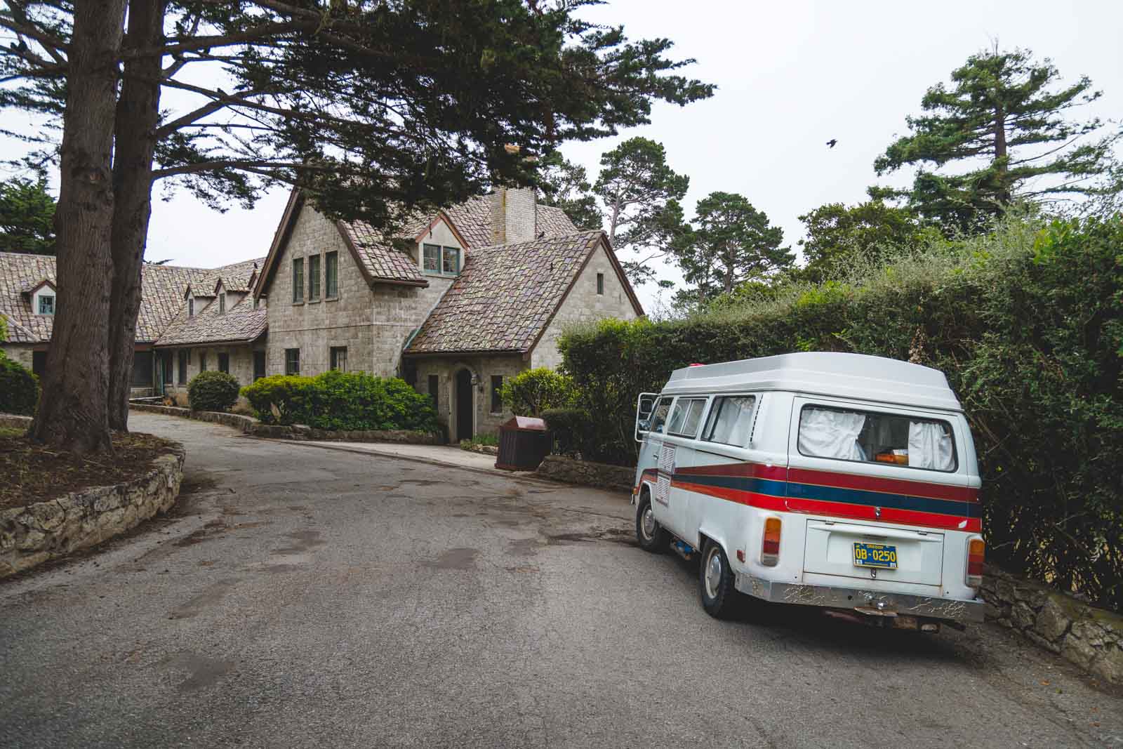
The stone church you walk into today was dedicated in 1797, under his successor. After the missions were secularized in the 1830s, it slowly fell into ruin, and the roof wasn’t repaired until 1884.
📍 GET THE ULTIMATE CALIFORNIA MAP 🗺️
Get our curated list of the best adventures and things to do north of LA loaded onto your maps with just two clicks!
✅ Waterfalls ✅ Hikes ✅ Viewpoints
✅ National Parks ✅ 1400+ Pins
What to see at the mission
It’s still an active parish, and it was named a basilica in 1960, so the mood is calmer than your average museum. Inside you’ll find 5-foot-thick walls, a curved ceiling that pulls your eyes straight up and Serra’s burial spot near the altar.
Out back are courtyards, gardens and museum galleries, including the small cell where Serra lived and died. Another gallery tells the story of Harry Downie and the restoration that rebuilt the place. We parked our VW bus right outside, and honestly the old stone facade alone is worth the stop.
Pope John Paul II visited in 1987, and Serra was declared a saint in 2015. His legacy is still debated, especially over how the missions treated California’s Native people, and the exhibits are a good place to start thinking about that.
The grounds and museums are closed Mondays and Tuesdays, and adult admission runs about $15. Weddings and services can limit access to the basilica, so check the mission’s visitor page before you go.
The 1769 cross on the bluff
Here’s the part most visitors never hear about. In fall 1769, Portolá led the first Spanish overland expedition up the coast to find Monterey Bay, a harbor an earlier explorer had only described from a ship. Coming at it by land, they didn’t recognize it, kept marching and ended up spotting San Francisco Bay instead.
Sure they’d overshot, they turned around and camped near the mouth of the Carmel River, still not realizing Monterey was just over the hill. Before heading back to San Diego in December, they planted a large wooden cross on a hill above the beach, with a written account buried at its base in case their overdue supply ship showed up.
Back in San Diego, Serra reportedly teased them for coming home from Rome without seeing the Pope. The cross standing on the bluff now is a redwood replica dedicated in 1944, in roughly the same spot as the original.
The easy walk out there
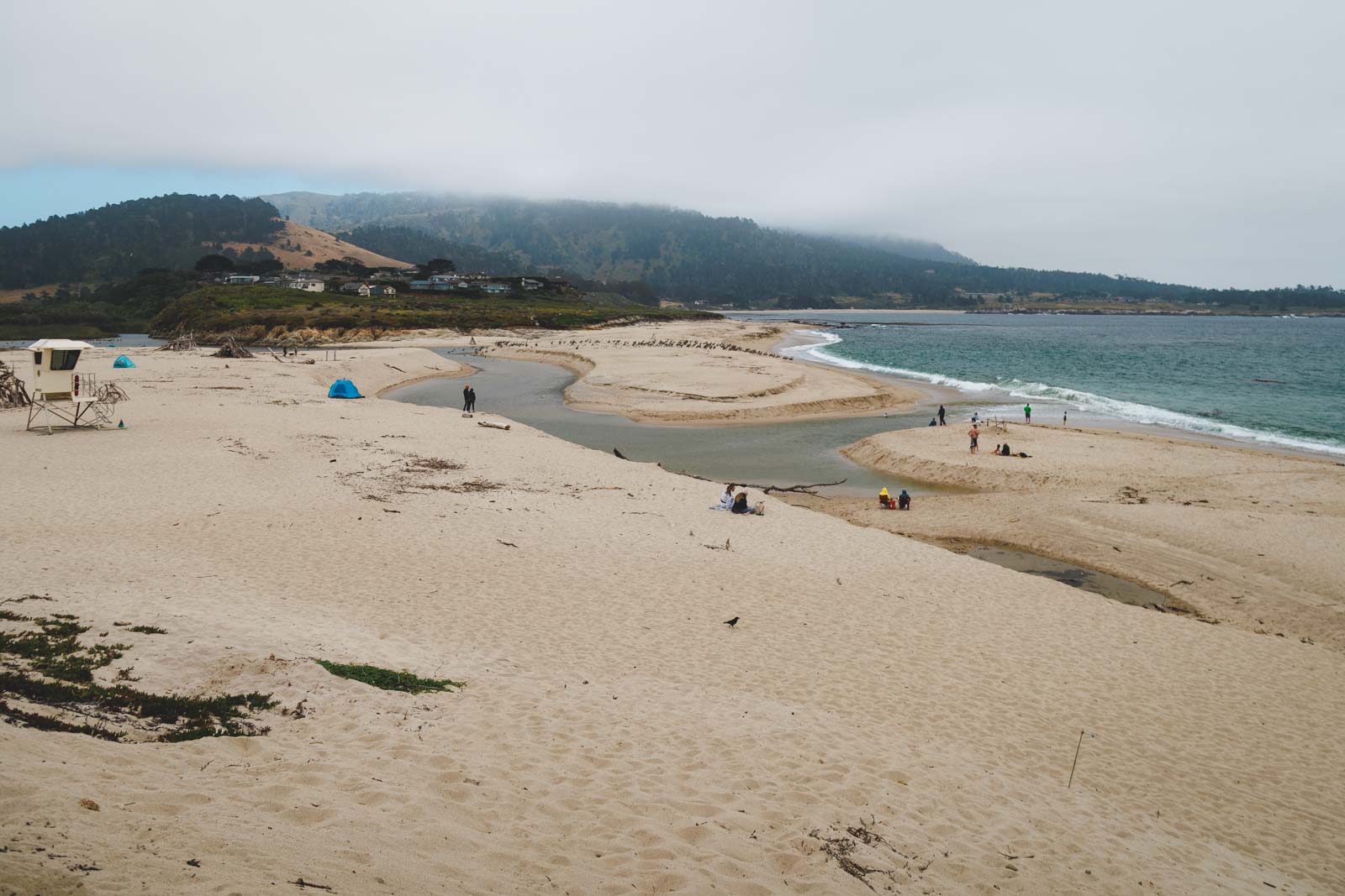
Start at the free Carmel River State Beach lot at the end of Carmelo Street and walk south along the sand, calm lagoon on one side and crashing waves on the other. The lagoon is a protected bird sanctuary, so bring binoculars for herons, egrets, ducks and pelicans.
At the south end, stairs climb to the bluff and a dirt path leads to the cross. Add the Carmel Meadows bluff trail and you’re looking at about 1.75 miles round trip with barely any climbing, plus views across the bay toward Point Lobos.

Heads up: once winter rains push the river through the sandbar, the beach gets cut in two and you can’t cross from the north side. When that happens, start from the south instead, at the Carmel Meadows trail access off Ribera Road and Highway 1.
The surf along this stretch is strong, with dangerous rip currents, so treat it as a walking beach, not a swimming one. Stay on the trail too, since there’s poison oak in the brush. Check California State Parks for current conditions.
How to plan the afternoon
Our take? Do the mission in the late morning, grab lunch in town, then save the beach for the last light. That bluff looks a whole lot better in soft late-day light than it does at noon.
Late fall is a great time for it, since the lagoon is busy with birds and weekday crowds are thin. Staying longer? Here’s our full list of things to do in Carmel-by-the-Sea.
Have you ever stood on that bluff and pictured a supply ship that never came? Tell us your favorite quiet corner of the Carmel coast!
Trip tips: grab a rental car to get out here, lock in your hotel before the good rooms are gone, or skip both and book a camper van instead.
Rules and fees change, so always confirm current requirements before you go.