Mount Tam once had the “crookedest railroad in the world,” and the ride back down ran on gravity alone
The best ride in Bay Area history didn’t have an engine. More than a century ago, a steam train hauled visitors up Mount Tamalpais, and the trip home was an open-air car that rolled down the mountain on gravity alone.
The tracks are long gone, but the mountain still holds onto the story. A replica of those coasting cars sits right at the top, and the short climb to the summit starts on a boardwalk of old railroad ties.
Psst, we made you a West Coast Adventure Map. Nearly 1,900 of our favorite spots, already pinned, ready to load into Google Maps in two clicks: grab it here.
A train with 281 curves and a lot of nerve
The Mount Tamalpais Scenic Railway opened in 1896 and climbed just over eight miles from Mill Valley toward the summit. Those eight miles packed in 281 curves, so it billed itself as the “crookedest railroad in the world.”
Picture it: curve after curve up the mountainside, the bay opening up a little wider at every turn. At the top waited the Tavern of Tamalpais, a hotel and restaurant where visitors ate, drank and stared at the view.
📍 GET THE ULTIMATE CALIFORNIA MAP 🗺️
Get our curated list of the best adventures and things to do north of LA loaded onto your maps with just two clicks!
✅ Waterfalls ✅ Hikes ✅ Viewpoints
✅ National Parks ✅ 1400+ Pins
The ride down had no engine at all
Here’s the genius part. The railway didn’t have enough locomotives to haul everyone, so its master mechanic came up with gravity cars: simple open-air coasters that rolled downhill on nothing but gravity and a hand brake.
They cruised down the mountain at about 12 miles per hour, with a railroad employee riding along to work the brakes. Later, a branch line carried them down into the redwoods of Muir Woods, and locomotives towed the empty cars back up for the next round.
Can you think of a better way to end a day trip? A slow, breezy, engine-free glide past the whole Bay Area sounds like the original theme park ride.
Why the trains stopped
Cars killed the crookedest railroad. Once people could drive themselves up the mountain, ridership dropped, and a 1929 fire damaged so many of the rail ties that the owners gave up on rebuilding.
The last train ran on October 31, 1929, and the tracks were pulled up in 1930. The route outlived the rails, though: hikers and cyclists still follow the Old Railroad Grade and the Gravity Car Road today.
Meet the gravity car at the top
Drive up to the East Peak parking area and you’ll find the Gravity Car Barn, a small museum sitting over a stretch of track at the old rail siding. Inside are historic photos, old train tickets, menus from the Tavern, a short documentary and a replica gravity car with a permanent home in the barn.
It’s run by volunteers from Friends of Mt. Tam and is generally open weekends from noon to 4 p.m. Hours can shift with volunteer availability, so plan a little flexibility around it.
Climb the planks to the lookout
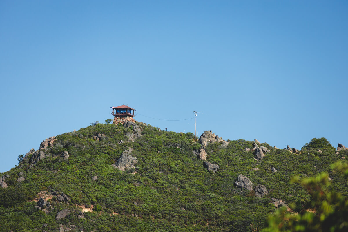
Now for the payoff. The Plank Trail starts at the far end of the East Peak lot, and its first stretch is a boardwalk built from old railroad ties, with a handrail on the downhill side.
It’s short, about 0.6 miles round trip, but it gains a couple hundred feet in roughly a quarter mile, so your calves will notice. The planks give way to a rockier, uneven path near the top, which means real shoes, not flip-flops.
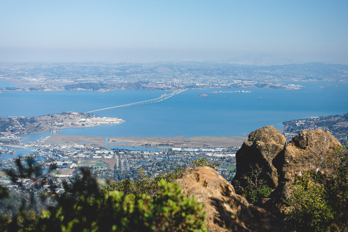
At 2,571 feet, East Peak is crowned by Gardner Lookout, built by the Civilian Conservation Corps in 1935 and still staffed by volunteers during fire season. On a clear day, the view runs from San Francisco and the bay out to the Farallon Islands, about 25 miles offshore, and sometimes all the way to the Sierra Nevada.
🏨 Need a place to crash nearby?
From rustic cabins to boutique inns—check prices and availability in just a click.
Then take the easy loop around the peak
If the summit scramble isn’t your thing, or you want a cool-down lap afterward, the Verna Dunshee Trail circles the peak in an easy 0.7-mile loop. It’s mostly flat and wheelchair accessible, with big views the whole way around.
My take? Do both. Climb the planks first while your legs are fresh, then let the loop be your victory lap.
Plan your trip up
East Peak is part of Mount Tamalpais State Park, which is open from 7 a.m. to sunset. Parking at the East Peak lot runs $8, paid by QR code on arrival or in cash with exact change.
Pack layers. When fog fills the valleys below, the summit can sit above it and run anywhere from 10 to 40 degrees warmer, then cool off fast once the sun drops. Check California State Parks for current conditions before you head up.
Want to stretch the day out? Our Mount Tamalpais State Park guide covers longer trails and the beaches below, the redwoods at the bottom of the old gravity line are covered in our Muir Woods hikes roundup, and there are plenty more hikes around San Francisco to keep you busy.
Trip tips: grab a rental car to get out here, lock in your hotel before the good rooms are gone, or skip both and book a camper van instead.
So be honest: would you have ridden an engine-free gravity car down a mountain with 281 curves, or taken the train both ways? Tell us in the comments.
Rules and fees change, so always confirm current requirements before you go.