Your Guide to Castle Crags State Park
With 28 miles of hiking trails, incredible rock climbing experiences, and killer views, it’s hardly surprising that Castle Crags State Park is considered one of California’s finest.
Whether you’re in the mood for a short stroll to Vista Point, where the views of Castle Point are jaw-dropping, or you would prefer to scale an almost sheer cliff face, there is something for everyone and all abilities! Even just driving to the park will showcase some of the most incredible scenery the area offers.
The castle element of the park gets its name from the pointed castle-like rocks that dominate the landscape. The jagged groups of stone put artificial castles to shame and call to rock climbers near and far.
If these impressive rock formations were not enough, it is also one of the best places in California to gaze upon the breathtaking Mount Shasta.
Here’s everything to know about Castle Crags!
Castle Crags State Park: Trails, Camping, Climbing and More
Literally, thousands of cars drive right past Castle Crags State Park every day, and less than 1% of them stop. If you want to be one of those 1%, trust us, you will not forget it.

We’ve split everything up that we love about Castle Crags State Park below! You’ll find the best hikes, notes about camping, where to rock climb, and where to paddle.
Don’t forget you’ll need your California Explorer Pass or pay the $8 day fee to get in.
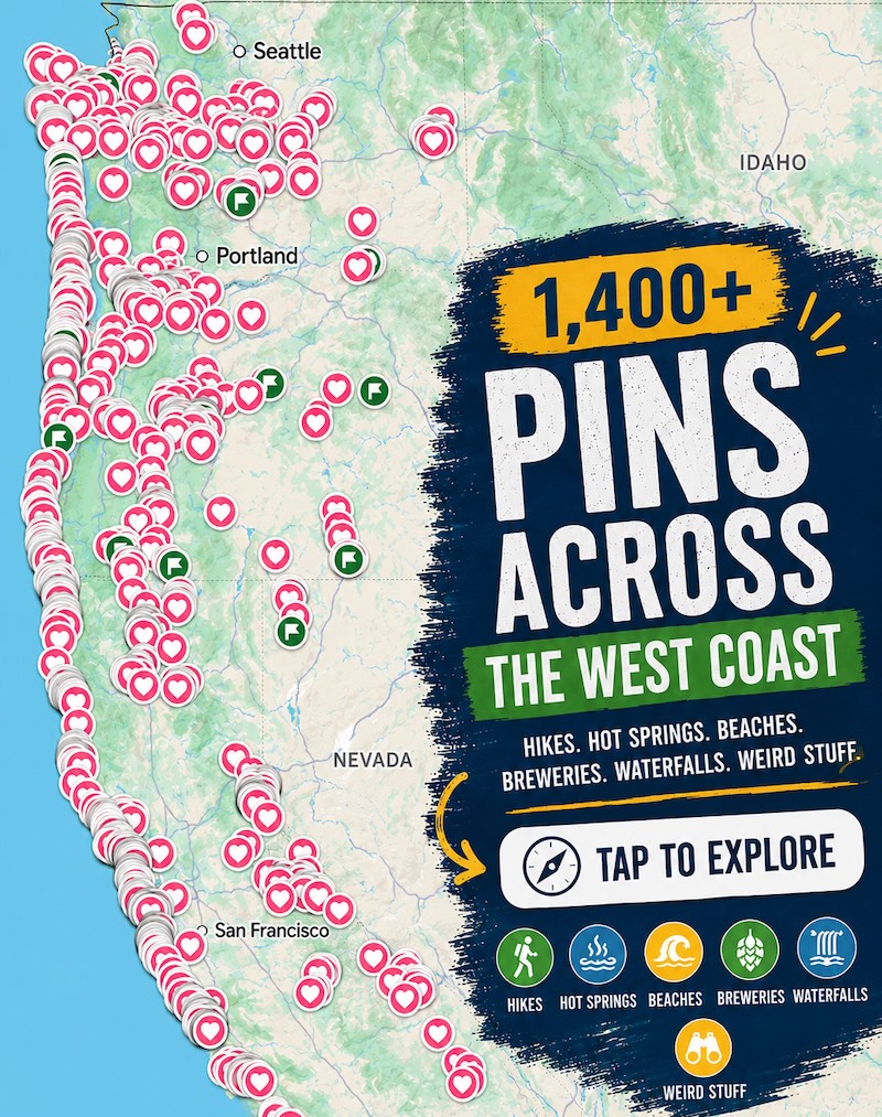
📍 GET THE ULTIMATE CALIFORNIA MAP 🗺️
Get our curated list of the best adventures and things to do north of LA loaded onto your maps with just two clicks!
✅ Waterfalls ✅ Hikes ✅ Viewpoints
✅ National Parks ✅ 1400+ Pins
Trails in Castle Crags State Park
This is no doubt the top reason to get to Castle Crags. Here are the most recommended hikes around the park.
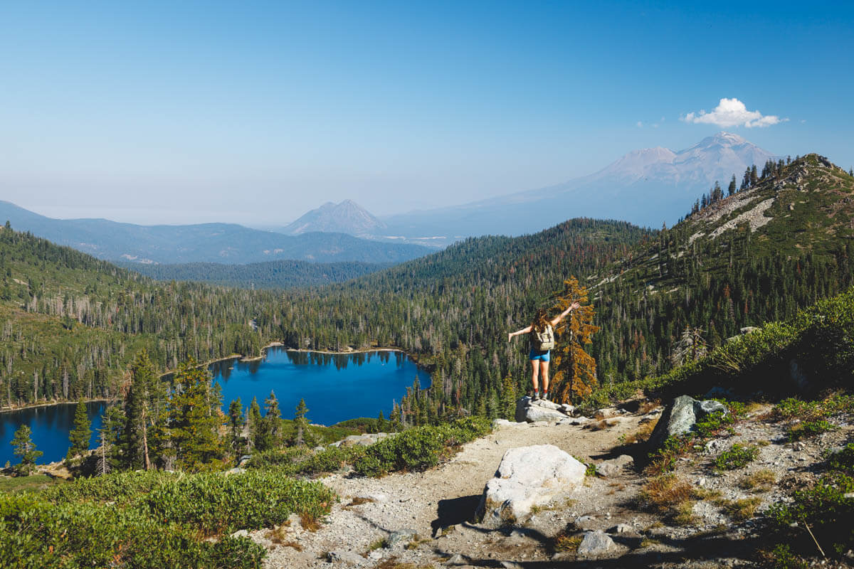
Heart Lake Trail from Castle Lake
Distance: 3 miles
Type of Trail: Out & Back
Difficulty: Moderate
Elevation Gain: 813.6 feet
The Heart Lake Trail from Castle Lake certainly gives you a lot of bang for your buck. The trail starts at Castle Lake and hugs the lake for a while before gradually beginning to head uphill.

The views as you climb are spectacular, as Mount Shasta sits on the horizon and is with you almost every step of the way. At some points, which path to take can get a little confusing, so we recommend having an offline map to help you out, or the AllTrails app gives you the right path to take as well.
After much climbing, you will eventually reach the picturesque Heart Lake, a tiny lake perched well above Castle Lake. As much as the name suggests that it will, unfortunately, you’ll find out as we did—Heart Lake does not in any form resemble a heart!
In fact, if you scrabble up the pile of rocks just past the lake, you get an awesome vista of Castle Lake below, and from the right angle, this lake looks more like the heart!

Once you have spent some time artistically photographing Mount Shasta in the distance with the lake below, it is time to turn around and head back down to Castle Lake (perhaps for a paddle and swim!). The best thing is, it is now downhill the entire way. This is one of the best Castle Crags hikes, so don’t miss it.
TIP: This hike is a bit far from the main entrance of Castle Crags State Park, so plan accordingly. You’ll want to head here, behind Lake Siskiyou. If you’re coming from the north you’ll want to hit this hike up first before heading a bit further south to get to the rest of the hikes in the park.
Milt Kenny Trail
Distance: 2.1 miles
Type of Trail: Loop
Difficulty: Easy
Elevation Gain: 295.2feet
The Milt Kenny Trail starts by following the Bob’s Hat Trail, climbing a little in elevation before joining the Milt Kenny Trail. After a while, you will head back down to the PCT campground. You will join the Campground Trail from here, passing through the Lower Loop Campground and back to the trailhead.

The Milt Kenny Trail takes you from the PCT to the hiker’s campsite in Castle Crags State Park, so this trail just takes you on a loop via the Campground Trail. The trail was named in honor of Mayor Milt, also known as the Mayor of the PCT.
Flume Trail and PCT Loop
Distance: 3.5 miles
Type of Trail: Loop
Difficulty: Moderate
Elevation Gain: 767.7 feet
The Flume Trail is a trail that connects up with the PCT Trail, so you have the option of just tackling the Flume Trail by itself or pairing it up with the PCT Trail to make a nice loop, which is quite a bit longer at over 7 miles.

The Flume Trail starts near the entrance to the park, which helps when it comes to its popularity. It slowly winds through the forest, gaining elevation as it goes, with a few stream crossings along the way. Look to the west as you near the trail’s north end, as the Grey Rocks are very impressive from here, as are the Castle Crags that will be towering above you!
If you go for the whole loop trail, we recommend going clockwise for the most awesome views of the crags.
🏨 Need a place to crash nearby?
From rustic cabins to boutique inns—check prices and availability in just a click.
Castle Dome
Hiking to Castle Dome is one of the most challenging trails in the Castle Crags Wilderness but also one of the most iconic. Castle Dome can be reached in several ways, but the Bob’s Hat Trail is usually the most popular route.

No matter which route you decide to tackle, the truth is it will be hard and steep. You will start the hikes through the forest-covered flanks of the rock formation before being flung out around the base of the Castle Dome rock formation.
Option 1: Bob’s Hat
Distance: 6.9 miles
Type of Trail: Out & Back
Difficulty: Hard
Elevation Gain: 2683 feet
Start the Bob’s Hat hike at Battle Rock, where you will find a parking area to park up and ready yourself for the climb. The first few miles are well-groomed and shaded, taking you uphill through the thick forest.

Keep going up, up, up the mountain, following the trail through the forest. The last mile is largely steep granite steps up to the summit.
Although you will likely be very tired at this point, the views at the top third of the trail are incredible and will help take your mind off the steep ascent. You can see Castle Dome, Castle Crags, and Mount Shasta on a clear day. Then it is just the final push to the top.
Option 2: Via PCT
Distance: 5.22 miles
Type of Trail: Out & Back
Difficulty: Hard
Elevation Gain: 2910 feet
Start the PCT Trail at Exit 726 of Interstate 5, where it should be pretty easy to find your way to the trailhead and begin your hike. The hike adds a few miles compared to the Bob’s Hat Trail, but there is only a slightly more elevation gain, so it shouldn’t be too much more of a challenge for the experienced hiker.
The first half of the hike is mostly covered in trees, therefore offering plenty of shade, so make the most of it. At this point, you will be following the Pacific Crest trail, taking in the beauty that it has to offer. The trail goes right through the park, so it is a great opportunity to take it all in before heading up to Castle Dome.

It is not long before the real climb begins, as you will hike continuously upwards along the well-marked trail to the summit.
Option 3: Crags Trail
Distance: 5.22 miles
Type of Trail: Out & Back
Difficulty: Hard
Elevation Gain: 2066 feet
The Crags Trail starts at Vista Point. Although there is nothing too technically challenging, there is quite a bit of elevation gain on this hike, although significantly less than the other two options. The trail starts off nice and flat through the forest with plenty of shade.
When you get to the fork, follow the Crags Trail on the left, and this is where the real climb begins. The trail turns to switchbacks, climbing steadily up to Castle Dome. After the switchbacks, the trail turns from compact dirt to granite and is slightly more difficult to climb.

Be sure to spend some time on the way up taking in the views of Mt Shasta and Castle Dome. Once you reach the trail’s end, ensure you take some time to take it all in.
Rock Climbing at Castle Crags State Park
Castle Crags State Park is a mecca for climbers. Just look at the rocks, and you will see why. I mean, it’s pretty epic looking!
Granite spires, domes, and walls jut dramatically up to the sky, just asking to be climbed. The climbs range in difficulty and height, with some paths as low as 20 feet and some an incredible 900 feet.

There are WAY too many climbs to name, but some of the most well-known include Cosmic Wall, Six Toe Crack, and NW Ridge. Be aware the park is quite remote and, therefore, does not get the column of climbers that more popular climbing sites do.
Although less traffic is nice, it means there have been fewer people before you to dislodge the loose, dangerous stone. Here’s more info on rock climbing Castle Crags.
🕒 Save hours of planning time! ⛰️
📍 Get The Ultimate West Coast Map
1400+ breweries, trails, waterfalls, beaches, and weird roadside stops—mapped for you!
Swimming and Fishing at Castle Crags State Park
If you are a keen and licensed angler, fishing at Castle Crags is another option after climbing and hiking. The trout here are only catch and release, and you need a license. You can cast for the trout in the Sacramento River or Castle Creek.

If it is warm enough, or you feel brave, you can swim in the Sacramento River and the bubbling stream. In the summer months, patches of the river are alive, with people cooling off in such a picturesque spot. Although it is a beautiful swimming spot, no lifeguards are on duty.
Camping at Castle Crags State Park
The nice thing about Castle Crags State Park is you can camp directly there. There are 76 developed campsites available, each with a picnic table, fire ring, and food locker, making it easy to cook and store your meals during your stay.
Although there are no water or sewer hookups, a few spots are available for small RVs. There are also a few environmental campsites located outside the developed area.

The park provides clean showers and flush toilets, and drinking water is available. Although there are a fair few campsites, it may still be worth booking ahead of you know the dates of your visit, as it can get busy during the summer months.
Things to Do Near Castle Crags
You don’t need to go too far to find your next adventure! Here’s what to do nearby.
Mount Shasta
Mount Shasta and the surrounding area are a must-visit in California for anyone passionate about outdoor adventure. This is probably our favorite town in the state!
It sits at the base of one of the largest volcanoes in California, Mount Shasta itself, providing endless opportunities to get out and about in the great outdoors for hiking, biking, climbing, skiing, camping, and so much more.

Although there are too many things to do in Mount Shasta to list here, a few things can’t be missed. The hiking around Mount Shasta is out of this world, with miles and miles of trails to enjoy, including the short walk to John Everitt Vista Point, the Bunny Flat Trail, and the Grey Butte Trail, to name a few.
Pluto’s Cave is just waiting to be explored, and there are plenty of waterfalls in northern California to chase too.
READ MORE: 15 Must-Do Mount Shasta Hikes!
Redding
The city of Redding is a short drive away and provides a great base for exploring the region and seeing an incredible Californian town to visit by itself.
The local coffee shops are some of the best in California, with delicious brews of all shapes, sizes, and flavors. They will prepare you for all the hiking and adventuring you have planned for the day.

The local bars and restaurants are not half bad either, so stay a while and check a few out. Don’t forget to see the stunning murals on Marker Street and admire the Sundial Bridge, probably the most iconic sight in the whole city.
Some of the best nearby hikes include the Sacramento River National Recreation Trail, which takes you from the Sundial Bridge to Shasha Dam. If you don’t fancy walking the 17 miles one way, you could hire a bike from town to make the journey.
READ MORE: 15 Top-Rated Things To Do in Redding, California for Adventurers
We hope this helped you plan your visit to Castle Crags State Park!